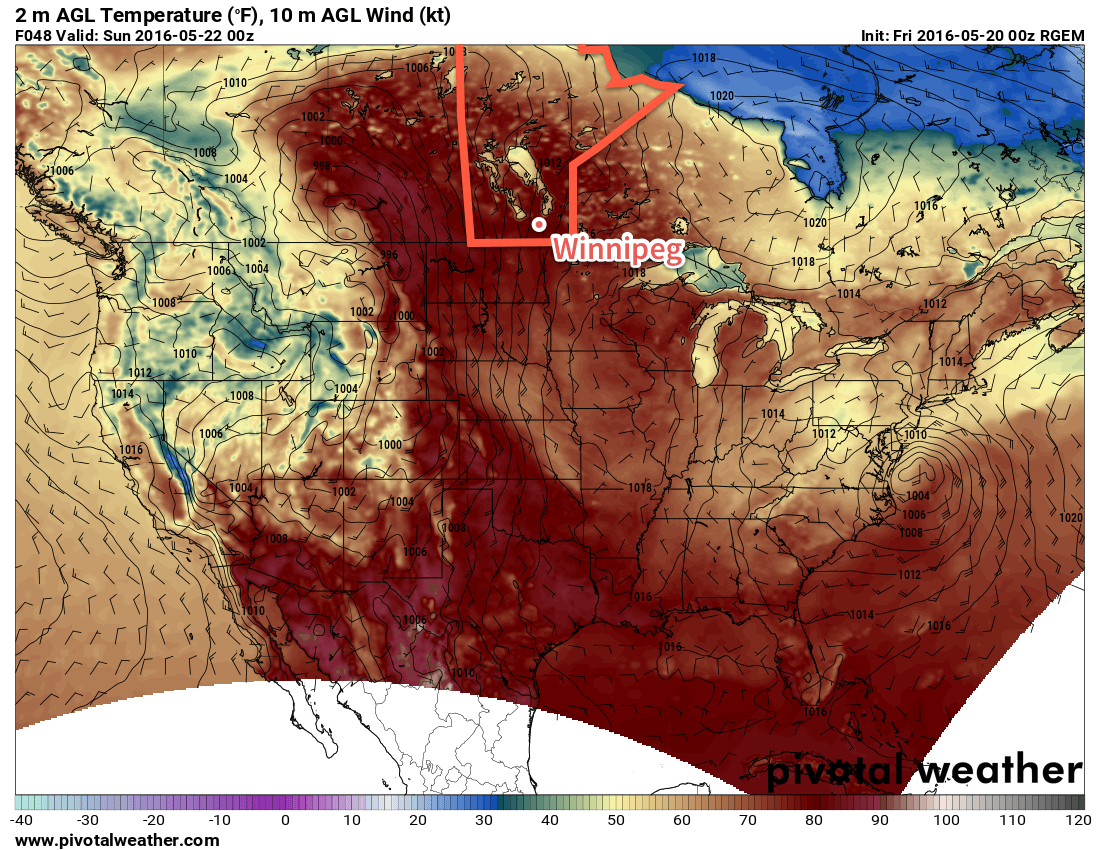
Summer warmth will continue in Winnipeg for the weekend as southerly winds continue to pull moisture northwards from the United States. By the latter half of the weekend, conditions will become noticeably more humid as a low pressure system begins moving into the region, bringing with it the first organized thunderstorm threat of 2016.
Today will be a beautiful day for Winnipeg & the Red River Valley with mainly sunny skies over the region as temperatures climb to a high near 26°C. Winds will be out of the south at around 20 km/h. There could be an isolated pop-up shower this afternoon through the RRV, but the chance for that will be quite small and not nearly as much shower activity is expected as was seen yesterday through the Red River Valley. Temperatures will fall to a low near 14°C tonight under clear skies.

Saturday will be another beautiful day with a high temperature once again near 26 or 27°C under sunny skies. It will be a little breezier than Friday with winds strengthening to around 30 km/h. Expect a low near 16°C on Saturday night with winds out of the south near 20 km/h.
Things will begin to change on Sunday as a low pressure system approaches from the west and some of the more humid air from the US begins working into Manitoba. The day will start off sunny with winds out of the south strengthening to 30-40 km/h. It will begin to feel more humid as the day progresses as dewpoint temperatures climb into the mid-teens. It will be warm, too, with a daytime high near 28°C.

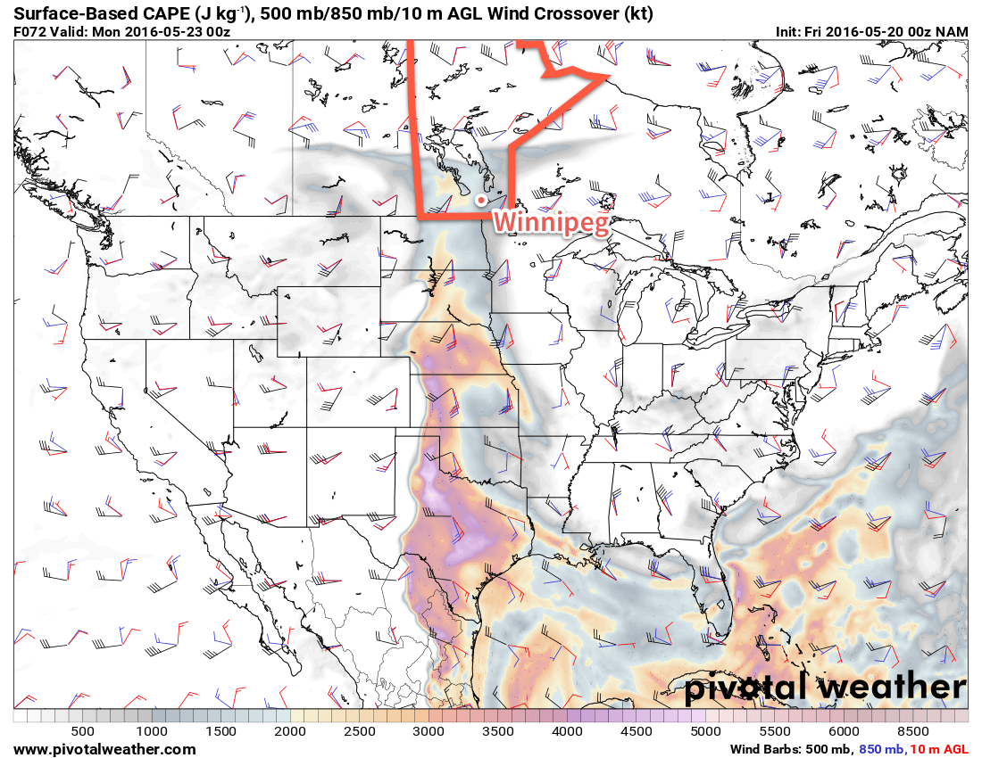
Through the afternoon, the threat for thunderstorms will develop across southwestern Manitoba and spread eastwards into the Red River Valley for the evening. Instability will peak over SW Manitoba in the afternoon with SBCAPE1 values approaching 2500 J/kg and then tapering off to the 1500-2000 J/kg range as the axis of instability moves into the Red River Valley. Fairly unidirectional wind profiles combined with 30-40 kt of surface to 500mb bulk shear will favour the development of a line of thunderstorms moving northeastwards. The thunderstorms will likely be moderate-to-strong but at this point the threat for severe thunderstorms seems relatively low in the Red River Valley. West of the Red River Valley there is a slight chance for severe thunderstorms, particularly early on in the event before the thunderstorms develop into a line. The primary threat over southwestern Manitoba with any severe thunderstorms that may form will be large hail. We'll continue to keep an eye on things as they develop and refine the storm forecast if needed.
Unsettled Start to Next Week
Holiday Monday will be lead off an unsettled start to next week. Daytime highs will fall back to the low 20's with showers or thundershowers likely to start off Monday and then general unsettledness continuing through the first few days of next week. Conditions will improve through the second half of the week with warmer temperatures returning to the region.
Winnipeg’s seasonal daytime high is currently 21°C while the seasonal overnight low is 6°C.
- Surface-based convective available potential energy ↩
