A weakening disturbance will push through the province today, bringing some rain to the region. As it clears out, the heat and humidity will build back in for week's end sending daytime highs back towards the 30°C mark.
Today will see Winnipeg stuck under overcast skies as a disturbance rolls through the region, bringing some showers to the region. The best chance for precipitation will begin mid- to late-morning through the early afternoon, with diminishing chances later in the afternoon as the system moves out of the region. The cloud cover and shower activity will keep things a bit cooler with daytime highs near 21°C.
Skies will clear in the evening as the disturbance departs the region and temperatures will fall to a low near 12°C. Thursday will be a beautiful sunny day across the Red River Valley with a high near 24°C and light winds. Temperatures will dip to around 14°C on Saturday night with just a few clouds.
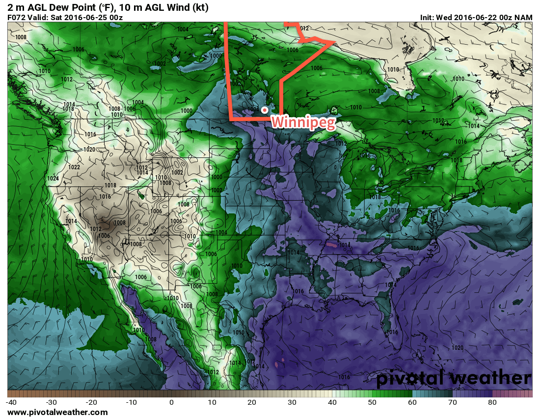
Friday will see a return of the heat and humidity as a southerly flow re-develops over the Red River Valley. Winds will strengthen to around 30 km/h out of the south ahead of a major developing weather system in the western Prairies. Temperatures will climb to the upper 20's in the afternoon with a few clouds moving into the image. Perhaps more notably will be the humidity, which will surface through the day after northwards transport on Thursday night. From a relatively comfortable dewpoint of 12-13°C in the morning, by the end of the day the dewpoint will climb into the 18-20°C range, making for quite a muggy afternoon.
Heading into Friday evening, more cloud will move into the Red River Valley with a risk of showers or thunderstorms. It's early at this point, but there may be a slight risk of severe thunderstorms throughout the Red River Valley, including Winnipeg, on Friday evening.
Long Range
Saturday will be a warm and very humid day that will likely bring mixed skies and the risk of thunderstorms. Sunday looks to be much cooler with more comfortable humidity with a continued chance of showers or thundershowers as a large upper low moves over the province.
Winnipeg’s seasonal daytime high is currently 24°C while the seasonal overnight low is 12°C.