Seasonal to slightly above-seasonal temperatures are on the way to Winnipeg this weekend alongside a couple chances for rain as a couple low pressure systems move through the province.
Today will be a relatively pleasant day in Winnipeg as sunny skies give way to some afternoon cloudiness as temperatures climb to around 25°C. Winds will be out of there south at 15-20 km/h. Expect a low near 13°C tonight with increasing cloudiness near morning.
A low pressure system will move but on Saturday, bringing fairly cloudy conditions and a chance of showers. Temperatures will reach a high near 23°C with winds out of the south at 20 km/h. Depending on the strength of this system, a few thundershowers may be possible, but no severe weather is expected at this time.
Sunday will be a much warmer day as a low pressure system tracking across the central Prairies draws air up from the south. Daytime highs will reach around 28°C work winds continuing out of the south at around 20-30 km/h. Skies will be partly cloudy, but the cloud cover will thicken up heading into the evening hours as a trough extending southwards from the low pressure system approaches. This feature will bring a chance for showers or thunderstorms Sunday evening into the overnight. Temperatures will remain miles on Sunday night with the temperature hovering near 20°C until late overnight when a cold front moves through and stops the temperature towards the mid-teens.
Update: Severe Thunderstorms Possible on Sunday
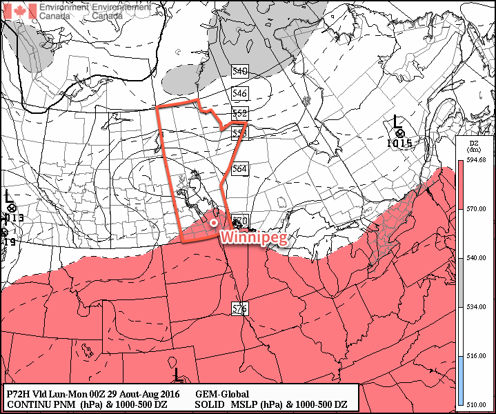
The threat for severe thunderstorms will return to Winnipeg, the Red River Valley, the Interlake and points eastwards as a warm and relatively humid air mass building in over the region clashes with a cold front pushing eastwards across the province later today.
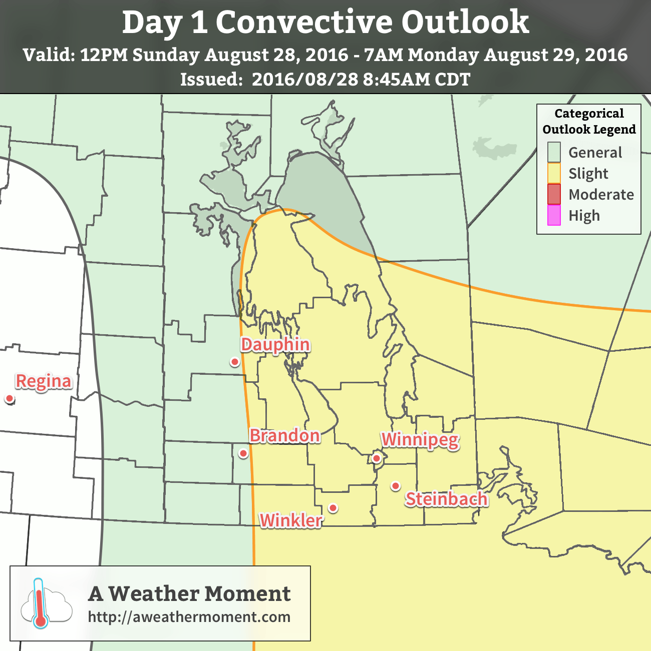
Today’s thunderstorms are expected to develop along a cold front pushing into the Interlake & Red River Valley late this afternoon, likely around 6-7 PM. These thunderstorms will likely grow fairly quickly a complex of severe thunderstorms that will move east-southeastwards with new storms developing as they build southwards down the cold front. These thunderstorms will be capable of all modes of severe weather: torrential downpours causing flash flooding, large & damaging hail, wind gusts exceeding 100 km/h, and tornadoes. It will be prudent to monitor Environment Canada for any watches or warnings that may be issued later today.
Shear: With a potent upper low entering northern Manitoba and dynamic cold front moving through the region, 40-55 *kt* of bulk shear produced with looping hodographs.
Trigger: The cold front combined with forcing from the escarpment should be enough to initiate convection today.
The thunderstorms will progress across the region through the overnight hours.
Winnipeg’s seasonal daytime high is currently 23°C while the seasonal overnight low is 10°C.