
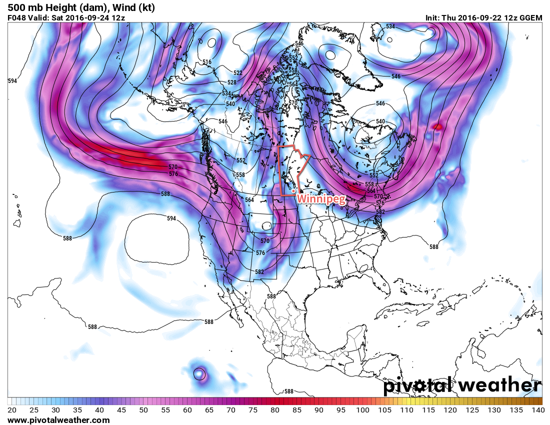
After a relatively benign week, unsettled weather is set to return this weekend as a slow-moving upper trough brings several waves of rainfall through the region.
Today will be the most pleasant of the next few, we see relatively pleasant temperatures for the latter portion of September under mixed to cloudy skies. The cloud is courtesy a large weather disturbance moving into the region driven by a strong upper-level trough1 developing over much of western North America.
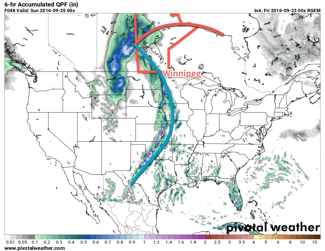
Winnipeg will see increasing cloud through the day as easterly winds pick up to around 20 km/h and temperatures climb to around 17°C. As the evening progresses, the entire Red River Valley will see an increasing chance of rain as precipitation lifts northeastwards with the warm front of this system. Precipitation amounts will likely be in the 5-15 mm range with this first wave, although if heavier convective pockets form, localized amounts of 15-25 mm may be possible.
Saturday morning will start with overcast skies with the chance of drizzle throughout much of the Red River Valley. Winds will be out of the southeast at 20-30 km/h with relatively warm temperatures—a high near 22°C is expected–but the main weather story will be a cold front pushing from the southwest to the northeast through the afternoon and evening. As it lifts northeastwards, a large band of rain is expected to develop along it and give another 5-15 mm in about a 3-6 hour window. Here in the Red River Valley I expect it to move through early Saturday night, but with complex systems like these, its possible that timing could change by 4-6 hours either way. We’ll keep an eye on it as things develop.
The cloud will likely break up a bit on Saturday night as winds taper off a bit and temperatures head to a low near 12°C.
We won’t be free from the clutches of this system on Sunday either. There’s a chance we have a nice start to the day with some sunshine, but things will quickly cloud up as a fair amount of wrap-around cloud and showers move in from the north behind this low pressure system. For areas that see rain, amounts should be fairly light with accumulations more in the 2-5 mm range, but will be accompanied by brisk northwesterly winds and a high near 17°C. The scattered showers will likely hang round through the overnight period as temperatures head down to a low near 10°C.
Summary
It won’t rain non-stop all weekend. It appears that the rain will come through 3 waves: first on Friday evening/night, then on Saturday afternoon/evening, and then on Sunday sometime midday to the evening and persisting until Monday morning. Rainfall totals will vary, but guidance suggests the heaviest rainfall will occur in Saskatchewan, clipping through Parkland Manitoba with over 50 mm possible.
Here in the Red River Valley, there may end up being a strong discrepancy of rainfall accumulation based on location, but in general totals of 10-30 mm seem possible at this point.
It’s worth noting that relatively minor variations in track of this particular system could result in significant shifts in how much rain we’ll see, so updates will be provided if needed as the weekend rolls on.
Long Range
After we escape the clutches of this system on Monday morning, conditions look fairly good through the remainder of the week. At this point, it appears Winnipeg will see near-seasonal highs in the mid- to upper-teens and overnight lows dipping just below 10°C through much of the week. Not a lot of cloud is expected, and winds look to to be fairly light. So a bit of a crummy weekend, but we’ll be making up for it with a stretch of pleasant fall weather!
- An upper-level trough is a feature in the upper atmosphere that is evident via a large dip southwards in the jet stream. ↩