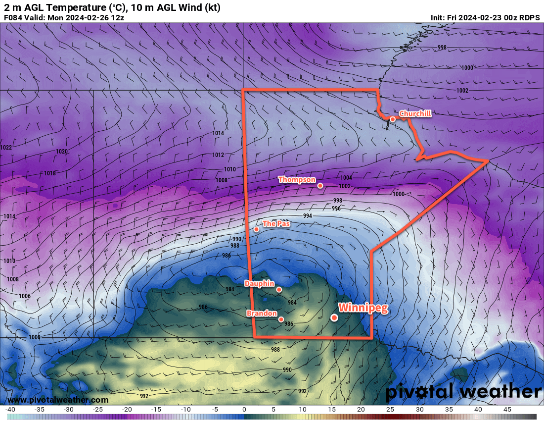
With daytime highs above freezing through the rest of the week, Winnipeg will see cloudier conditions develop as the snowpack across the region undergoes significant melt.
Mild temperatures with daytime highs above freezing will be commonplace across the southern Prairies this week.
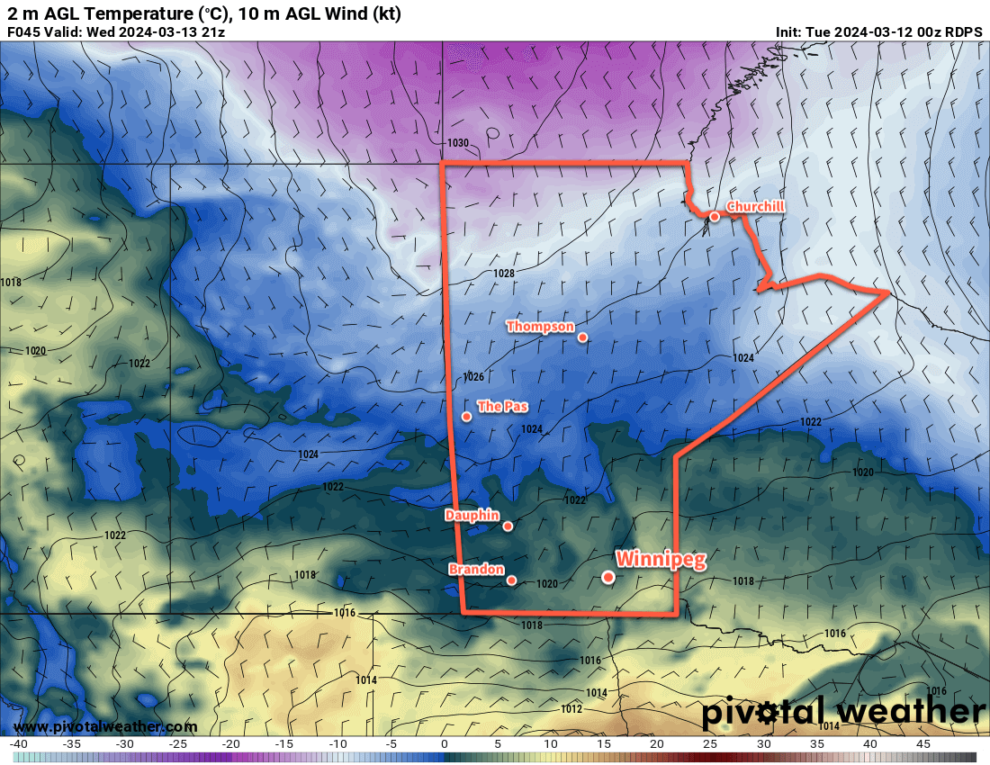
Warm Pacific air will sweep across the Prairies this week as upper ridging gradually dominates the upper air pattern over the coming days. As a result, Winnipeg will see daytime highs that climb above freezing throughout the work week.
It won’t all be sunshine though; a cold front dipped southwards overnight and another frontal boundary will slowly drop southwards through the province over the coming days. This will bring cloudier skies to the region with daytime highs in the +1 to +4°C range. Dew point values are expected to climb above freezing both today and tomorrow which will aid in the melting and erosion of the snow pack. Overnight lows will dip into the -5 to 0 °C range over the next several nights.
A weak disturbance will bring light snow to southwest Manitoba on Wednesday; while there may be a chance of flurries in Winnipeg, the system is likely to fall apart west of the Red River Valley.
As the melt continues through the week and the cloud lingers across the region, the chance of seeing fog patches or mist will increase. Northerly winds will pick up in the second half of the week which should help clear out any lingering moisture in the air.
Long Range Outlook
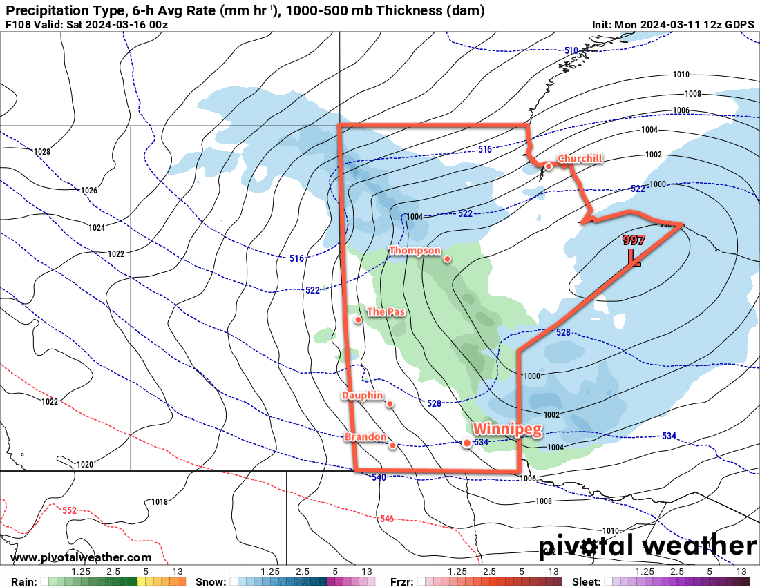
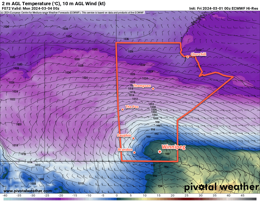
The next system of note will be a low pressure system dropping southeastwards through Manitoba on Friday. This system could bring a mix of rain and snow to the Red River Valley, though current indications are that it should pull enough warm air eastwards that most of the precipitation would be rain.
A low pressure system moving through Manitoba on Friday will bring a mix of rain and snow to the province.
This system could bring rain amounts ranging from a trace to the 5–10 mm range across the Red River Valley. With a cold front swinging through on Friday night, it would leave behind cooler weather with a chance of flurries into the weekend.
Today’s seasonal daytime high in Winnipeg is -2 °C while the seasonal overnight low is -12 °C.
Seasonably cool weather will be the trend for much of this week with sunny conditions interrupted mid-week as more snow moves through the province.
A low pressure system will lift northwards through southern Manitoba on Wednesday night.
Cool weather will continue across southern Manitoba this week, supported by a slow-moving upper-air pattern called a “high over low block.” In the upper levels of the atmosphere today, an upper low sits over southern Alberta and Saskatchewan while an upper high sits to its north over the northern Prairies. This configuration of upper-level features is stable and results in a slow-moving pattern. As a result, the weather will be gradual to change this week, save for a mid-week system that brings more snow.
Today, a ridge of high pressure crossing the province will bring sunny skies and cool weather. It’s a chilly start to the day and the recovery will bring Winnipeg to a high near -10 °C this afternoon. A few clouds will linger overnight as temperatures drop into the mid-minus teens.
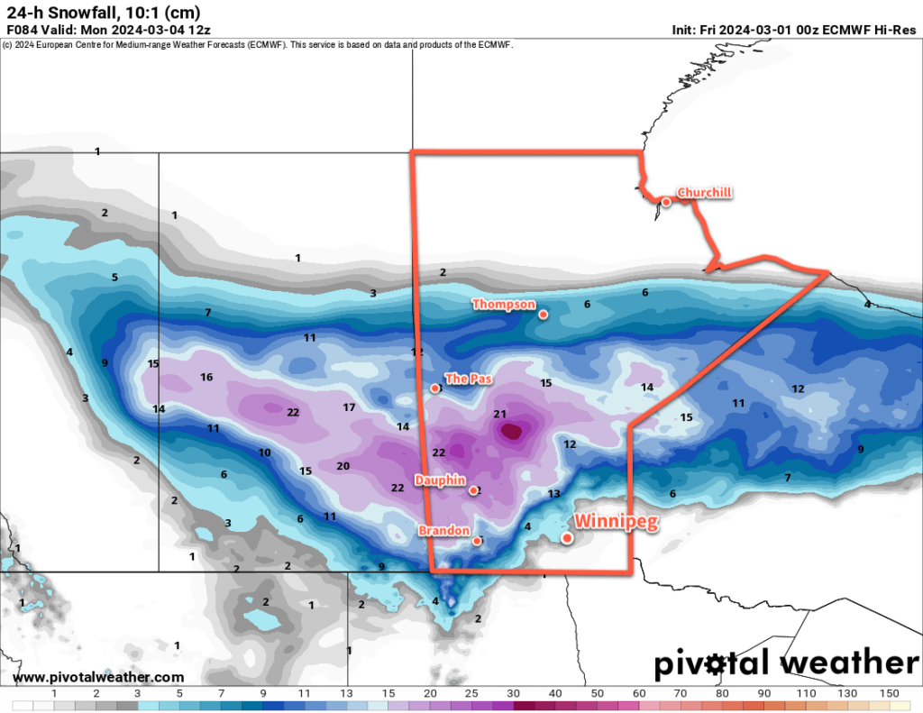
On Wednesday, a low pressure system will lift out of the Dakotas into southeastern Manitoba, spreading a band of moderate to heavy snow into the province with it. Skies will cloud over early in Winnipeg with snow likely beginning midday and lasting through the night. Daytime highs will climb to near-seasonal values with a brisk northeast wind up to 30 gusting 50 km/h.
The low moving through the province will drop close to 10 cm of snow across much of southern Manitoba.
Winds will shift westerly overnight as the low lifts to the north and the snow tapers off. This storm will leave behind close to 10 cm of snow across much of southern Manitoba by Thursday morning. Fortunately, areas hit hardest by the weekend’s storm system will see lesser amounts from this system than areas in the Red River Valley and east. Temperatures will head to a low in the -15 to -10 °C range on Wednesday night.
Skies will clear out on Thursday with temperatures rebounding into the -10 to -5 °C range. Winds will taper off through the day. Temperatures will dip back down close to -20 °C on Thursday night as another Arctic High moves into the province.
Long Range Outlook
The Winnipeg area will see below-seasonal temperatures on Friday with highs in the -10 to -5 °C, but a shift in conditions will begin to develop on the weekend.
That high over low block will finally exit the region, and an upper ridge will begin to develop in the west. As it amplifies and begins to spread eastwards, milder air will push back across the Prairies. Temperatures will rise to near-seasonal values on Saturday and likely to above-seasonal values on Sunday.
Above-freezing daytime highs look likely beginning Sunday and lasting through the first half of next week.
Today’s seasonal daytime high in Winnipeg is -4 °C while the seasonal overnight low is -14 °C.
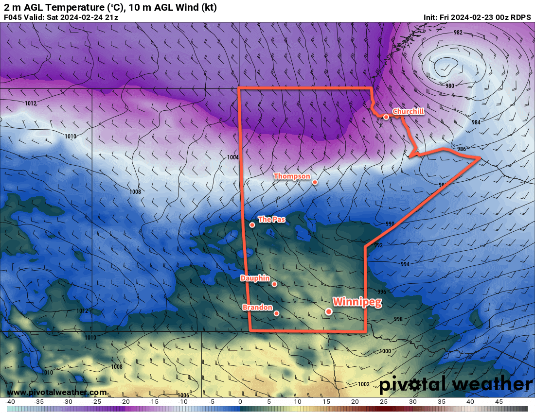
A winter storm moving into the province on Sunday will bring a mix of wintery weather to southern Manitoba.
A potent winter storm will move into southern Manitoba this weekend, but Winnipeg may be spared from the worst of it.
Before the storm arrives, though, it will be a pleasant start to the weekend in Winnipeg. Temperatures will climb above freezing today as a low pressure system crosses through central Manitoba. It will drag mild Pacific air across the south, sending daytime highs into the 5 to 10 °C range through the Red River Valley.
Breezy southerly winds up to 30 gusting 50 km/h this morning will ease midday as Winnipeg moves into the warm sector of this system. The region will see mixed skies develop this afternoon, followed by more organized cloud cover as a cold front slumps into the region tonight. As the cold front moves into the region, northwest winds will pick up into the 20 to 30 km/h range and then ease overnight. Temperatures will dip to a low near -10 °C.
Saturday will bring mixed skies to the region as the next weather system to impact the region begins to take shape. Northeast winds will pick up into the 20 to 30 km/h range as a low centre begins to develop in the Northern Plains of the United States. Skies will cloud over through the day with light snow possible by the late afternoon or evening.
Temperatures will climb to a high near -5 °C by the evening and continue to rise to the freezing mark by Sunday morning. The snow will taper off overnight, leaving behind a couple centimetres, and be replaced with a risk of freezing drizzle into Sunday morning.
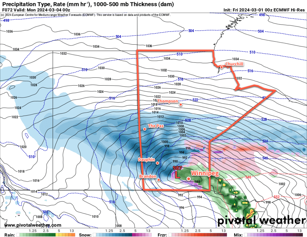
On Sunday, the low centre will lift out of the United States and into Southern Manitoba. This system impact the entirety of southern Manitoba and bring adverse winter storm conditions to many regions. In the sake of brevity, here’s what to expect for each weather element.
Heavy Snow
This low pressure system will spread an area of heavy snowfall across southern Saskatchewan and into southern Manitoba. Because this low will bring a surge of warm air into the Red River Valley and SE Manitoba, there is uncertainty as to how far east the heavy snow will reach.
This storm will spread heavy snow through Saskatchewan into western and central Manitoba. There is uncertainty to how far southeast the notable snow accumulations may push.
That said, through southwest Manitoba, Parkland Manitoba, and much of the Interlake, this system will bring 15 to 35 cm of fresh snow. Amounts will taper off gradually into central Manitoba and sharply into the warm sector of above-freezing air.
Freezing Rain
This system will support a band of freezing rain that develops along its advancing flank and will likely cut across the Red River Valley and SE Manitoba. Note that this risk area could shift west or east over the coming days as the system takes shape. That said, the risk of freezing rain will begin early Sunday and persist through the day. Freezing rain across southern Manitoba will come to an end on Sunday evening as the low begins to track east and colder air sweeps into the southeast corner of the province.
This storm will bring a mix of wintery precipitation to southern Manitoba.
Rain
To the east and south of the freezing rain band, temperatures will warm enough for any precipitation that falls to fall as rain. This will include much of SE Manitoba but could push as far west as Winnipeg and north as Lake Winnipeg. Rainfalls totals could reach as high as 5 to 10 mm, but much more of the precipitation should fall on the cold side of the system as snow.
Additionally, there are early signals that as the cold front wraps around this low, convective cells may develop along the rain band associated with it. A few rumbles of thunder and heavier rain showers can’t be ruled out close to the U.S. border late Sunday into the evening.
A Guess for Winnipeg?
In Winnipeg, it looks like a risk of freezing rain on Sunday morning will transition to light rain, and then to periods of snow in the afternoon as cooler air moves in. There is significant uncertainty with this, though, and even a 50 km shift in storm track could end up changing the forecast to 10 to 20 cm of snow. On the other hand, if the storm ends up 50 km further west, much of the Red River Valley, Winnipeg included, could be in this storm’s dry slot and see little beyond a couple waves of light snow or rain and a lot of drizzle.
Be sure to keep an eye for updated forecasts as the event draws near. If you’re in SW or Parkland Manitoba, be prepared for poor conditions on Sunday as a notable winter storm moves through the region.
Long Range Outlook
Light snow will taper off across central Manitoba on Monday. There may be a small chance of flurries in Winnipeg on Monday, but the activity should stay mainly to the north. The first half of next week will be cooler with highs in the -10 to -5 °C range.
Another low pressure system will slice its way northwards through Manitoba mid-week; it will bring another chance of mixed precipitation to the province and bring milder weather back to the Red River Valley and areas east.
Today’s seasonal daytime high in Winnipeg is -5°C while the seasonal overnight low is -15 °C.
Winnipeg will end the work week with near-seasonal temperatures, but more warmth is on the way for the weekend.
A low pressure system crossing the southern Arctic into Hudson Bay will drag another wave of mild air into southern Manitoba this weekend.
An Arctic high slumping through southern Manitoba will bring near-seasonal temperatures to the region with daytime highs comfortably in the -10 to -5 °C range. Skies will be sunny with light winds that begin to pick up out of the south in the evening.
A strong low pressure system will begin tracking eastwards through the southern Arctic today, and by tonight it will start dragging a warm front across southern Manitoba. Temperatures will dip to a low near -10 °C tonight, then climb into the -5 to 0 °C range by Saturday morning as the warm air pushes into the Red River Valley.
Saturday will bring partly cloudy skies to the region with highs jumping up into the mid-single digits. Breezy southerly winds will shift westerly through the day, hovering in the 20 to 30 km/h range. A weak cold front will slump through the region on Saturday evening. Temperatures will dip to a low in the -10 to -5 °C range overnight.
A ridge of high pressure will cross the region on Sunday, bringing light winds and a high near freezing. Skies will again be partly cloudy but otherwise there will be little weather to talk about to end the weekend.
On Sunday night, a potent Alberta Clipper is forecast to begin ejecting eastwards across the Prairies; it will bring much warmer air surging northwards into the Prairies ahead of it as it tracks towards Manitoba overnight. This warmer air pushing into the region will keep overnight lows mild in the -5 to 0 °C range with cloud building in as moderate southeast winds pick up.
Long Range Outlook
Monday’s weather in Winnipeg will be dependent on the exact track of the Alberta clipper. If it tracks more southerly, then the city will see cloudy skies and likely morning snow as the warm front slides through and evening snow as the system’s cold front slams through. In this case, a daytime high near 5 °C wouldn’t be unreasonable.
If, against the odds, the system tracks more northerly, then Winnipeg may escape the morning snow and see temperatures soar into the upper single digits as southwest winds mix mild Pacific air to the surface. Either way, a potent cold front will slam through in the evening and bring strong northwest winds and plummeting temperatures.
A potent Alberta Clipper will cross the Prairies on Monday, bringing more mild weather to the south while bitterly cold temperatures push into the north.
A huge Arctic high will slump into the region behind the clipper, sending temperatures plummeting rapidly. Temperatures will likely drop into the -20 to -15 °C range on Monday night, barely recover on Tuesday, and then drop into the mid-minus 20s on Tuesday night.
This clipper will likely bring a swath of 10 to 20 cm of snow across the central Prairies, but along the Trans-Canada Highway corridor and areas south, there’s more uncertainty with amounts and whether the precipitation will be rain or snow.
The cold snap will be short lived after this system as the upper pattern continues to favour progressive systems. Wednesday will bring below-seasonal highs to the region for another day, then a warmup begins heading towards the weekend!
Today’s seasonal daytime high in Winnipeg is -6 °C while the seasonal overnight low is -17 °C.