A large spring storm will bring the most significant rainfall to the Red River Valley since last October. It will be mainly rain that falls over the next couple days, however higher-terrain areas of Parkland Manitoba will likely see snow feature more predominantly. This system will be fairly long-lasting, too, with precipitation pushing into SW Manitoba this morning and lingering through Friday.
Wednesday
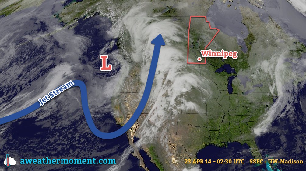
The wet weather over the next couple days is being caused by a strong upper-level trough (depicted in the picture at the top of this post) that is pushing inland from the Pacific. This feature will spawn an elongated trough of low pressure with embedded low pressure centres within it that spans all the way from Alberta through Saskatchewan, Manitoba, and southwards to Texas. This large feature will be aided by an upper-level low tracking along the Canadian/US border which will amplify the precipitation through the Canadian Prairies.
So, what will we see? Rain will spread into southwestern Manitoba this morning and slowly – quite slowly, actually – spread eastwards through the day towards the Red River Valley. By the afternoon, rain should push into the western RRV, but likely won’t reach Winnipeg and into the eastern RRV until late this afternoon or into this evening. By the evening, most areas across Southwest and Parkland Manitoba will likely see around 10-20mm of rainfall, with the potential for some localized amounts of 20-25mm.
Rain will continue to push eastwards through the night, bringing fairly steady rain to most areas in Southern Manitoba. Areas in extreme southwestern Manitoba may see things taper off as the main axis of rain begins shifting to the northeast. Another 5-10mm of rain will fall in most places, however in higher elevations of Parkland Manitoba the rain will switch over to snow overnight with 5-10cm of accumulation possible.
Thursday
Thursday will see rain tampering off in Southwest Manitoba, but being reinvigorated over the Red River Valley and Interlake by another shot of moisture lifting northwards along the trough line. Here in the RRV around another 5-10mm will fall, however portions of the valley into the Whiteshell may end up seeing 10-15mm if the heavier rain arrives a little earlier.
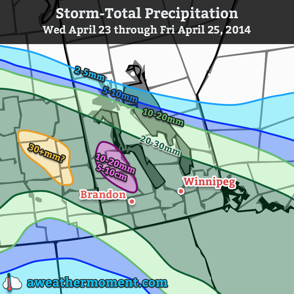
Light rain will persist through much of Thursday night and perhaps become mixed with snow as we approach our low temperature of around 1°C. Another 2-5mm of precipitation is expected.
Friday
The system will finally begin pushing out of the region on Friday, however an lingering trough will hang back into the province for much of the day, spreading some showers or, at times through the morning, light flurries through the region. Further amounts of precipitation will be minimal – likely less than 2mm.
Things look to clear out for a sunny weekend. Saturday’s high will be below normal, somewhere around 6°C or so, and Sunday will return to a near-normal high in the low teens. The nice weather may be short-lived, though, as weather models are hinting towards the development of a Colorado Low that would impact Southern Manitoba starting Sunday night.