After a couple days of bitterly cold temperatures, the end is already in sight for Southern Manitoba. Perhaps we shouldn’t complain, though, as Southern Manitoba got off pretty easy compared to the rest of Prairies, where temperatures plummeted to nearly -40°C through most areas, let alone considering the wind chill on top of that.

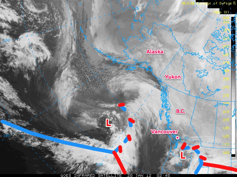
A powerful system pushing towards B.C. will bring a significant change to our weather pattern this weekend. As this system pushes into the western portions of the continent, the Arctic Vortex, currently situated near Baker Lake, NU, that has been pushing extremely cold air over the Prairies will begin to collapse and retrograde back towards the Gulf of Alaska.
As this happens, the large-scale flow over the Prairies will shift from northwest to southwest, and what a difference 60 degrees can make.
Temperatures will begin to rise on Saturday, as the arctic air begins to be pushed back northwards, and most areas in Southern Manitoba should see temperatures rise to around -12°C. Temperatures will continue to rise overnight and through Sunday up to around -5°C over the RRV as the actual low approaches.
We’ll likely see a couple of cm of light snow Friday night through Saturday as the warm front slowly lifts from North Dakota into the Interlake region. Past that, it gets a little tricky, as some models are forecasting substantial snowfall through Sunday while others keep all snowfall well north of the Trans-Canada Highway. Best case scenarios bring only light snow to the RRV on Sunday night in the wrap around for this system, while more pessimistic approaches bring close to 10cm of snow to our area through light-to-moderate snow through Sunday and Sunday night. It should start to become a little clearer over the next day or two, as the low approaches the coast. Currently, ensemble models predict that we’ll see little snow, and that accumulations should occur through the Interlake, and not as far south as Winnipeg.
After Sunday, we’ll cool back down to seasonal to slightly-above seasonal temperatures through much of next week, with daytime highs generally between -15°C and -10°C. All in all, next week looks quite pleasant. We’ll be sure to provide updates in the comments on how much snow we can expect for Sunday through the coming days!
