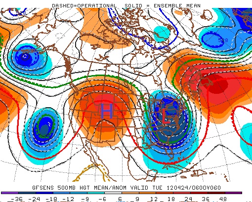
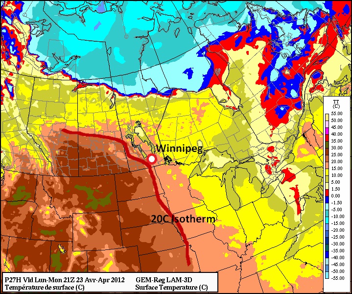
This week will start out on the warm side as a high pressure ridge edges into Manitoba. Temperatures on Monday and Tuesday are expected to reach or exceed 20C, which will mark the first occurrence of a 20 degree reading since April 6.

Highs on Monday should be around 20C in most of Southern Manitoba. Skies will range from mainly sunny to mainly cloudy, with Winnipeg and the Red River Valley tending to be on the cloudier side and Western Manitoba on the sunnier end. As such South-Western Manitoba will likely be a bit warmer than the rest of Southern Manitoba. Tuesday will feature much the same weather as Monday with temperatures once again climbing up to around the twenty degree mark over Southern Manitoba. Skies on Tuesday will mostly likely be a mixture of sun and cloud, preventing temperatures from climbing much above 20 degrees. Should Monday or Tuesday be sunnier than currently expected you can easily add a couple degrees onto the temperatures listed above.

A cold front will slice through Manitoba on Wednesday, dropping our temperatures back down to normal values. Highs on Wednesday are expected to hover in the low teens in Southern Manitoba, while on Thursday temperatures will remain stuck in the single digits. A recovery in temperatures in expected to begin on Friday and stretch into the weekend.
No significant precipitation is expected this week, although some weak shower activity might form as a low pressure system and associated cold front pass through on Tuesday night and Wednesday.
Elsewhere in Weather News
Australian Rains
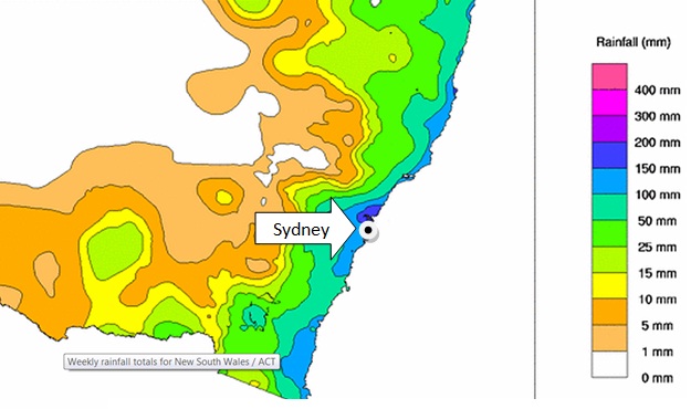
As Australia’s summer transitions into fall, heavy rains have pummelled its capital, Sydney, and surrounding regions resulting in flash floods throughout the area.

Between Monday, April 16th and Wednesday, April 18th, the New South Whales (NSW) region was hit hardest from the flooding where some areas received between 150mm-200mm of rain. The flash floods were triggered by a number of towns receiving rainfall of 40mm/h over a couple hours, and the fact that the soil was saturated in those areas due to heavy rainfall that occurred over the past month.

Emergency crews were called to assist residents whose cars were overtaken by water and also to help those trapped in their homes as water levels rose in a matter of hours. Utility crews were also busy due to more than a thousand people losing power.
Unfortunately, more rain was forecast to fall this weekend as another slow moving trough/cold front stretched across the whole region. No additional flash flooding was reported with this latest rainfall, however more rainy days are expected to hit the coast this coming week which increases the risk of further flooding in the region where another 15mm-25mm are expected through to Wednesday.
This event comes just two months after the region located north of NSW, Queensland, was hit hard by flooding (brought to you on February 27th post). Australia’s eastern coast has seen its fair share of dangerous flash flooding already this year.
Elsewhere in Weather News has been provided by Matt
