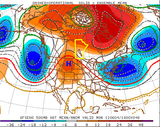
After a warm weekend, which featured a beautifully Saturday and stormy Sunday, we will stick with warm to hot weather to start the week. A ridge of high pressure will gradually build into Southern Manitoba this week, allowing us to keep the warm conditions experienced on the weekend.

Monday will be a warm to hot day in Southern Manitoba, with high temperatures in the mid to high twenties under mainly sunny skies. Tuesday will again be warm and sunny day, with high temperatures in the low to mid twenties. An easterly flow pushing slightly cooler air into the province is the reason why Tuesday will be a bit cooler than Monday. Temperatures will climb again on Wednesday, as we reach back up into the high twenties under a south-easterly flow.
The weather through late week is, as usual, less certain. Thursday looks to remain warm but Friday into the weekend may be cooler. A low pressure system is currently forecast to cross Southern Manitoba on Friday, which will be a catalyst for cooler weather. More details will be available later in the week.

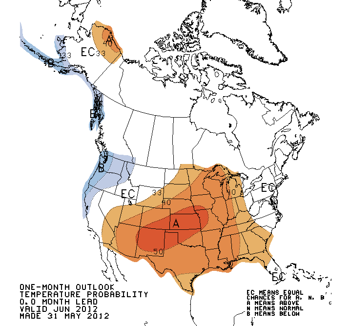
A quick update on the June forecast. Most long-range models are showing a ridge-trough pattern dominating North America through June. This pattern means a ridge will likely reside over Central/Eastern North America through a good part of June while a trough sits over Western North America. Southern Manitoba will be frequently caught in between these two features, causing our weather to be variable with hot spells as well as some cooler outbreaks. This pattern may also promote more chances for thunderstorms, though this is not as clear-cut.
At any rate, enjoy what will be a nice first half of the week!
