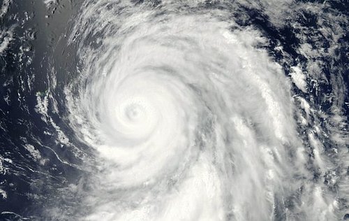
Typhoons and Hurricanes Spin Up in Northern Hemisphere
Mother Nature has been very busy world-wide, wreaking havoc of all forms this past week. The Deluth floods, tornadoes in South Dakota, and as reported in today’s EIWN post—typhoons and hurricanes have spun up in the North-West Pacific and North Atlantic basins.
This past Sunday, June 17th, typhoon Guchol (known as Butchoy by the Philippines) gave a scare to the Philippine islands’ residents as it scooted a couple hundred kilometers to the east of the islands while racing northwards. Minor storm surge and the outer spiral bands of Guchol brought heavy rains and flash floods to the area. Making matters worse was the fact that the monsoon winds were occurring, feeding warm, moist, air from the equator. The streets in Manila were flooded requiring people to walk through waist-high water to reach their destination. Landslides caused by the heavy rains were also reported in the region. The eye of the typhoon didn’t hit land in Manila however; it kept roaring in a northerly fashion towards Japan where it finally made landfall on Tuesday. Intense winds were recorded above 200km/h near the eye of the storm. Flash-flood conditions existed in areas where the typhoon made landfall and near the core, through the more mountainous regions of Japan. About 80 people had injuries relating to the storm and one person died when his house was torn apart by the vicious winds. Since then, Guchol has been downgraded to an extratropical storm and has weakened significantly as it’s path continues over land and it moves away from the warm sea surface temperatures that gave it it’s energy.


Meanwhile, in the North Atlantic, the third-named storm of the year, Hurricane Chris, formed far off to the south-east of Newfoundland, in the middle of the North Atlantic but poses no threat to land. This hurricane is only the second most northerly hurricane in the history of record keeping. It managed to form in the 22°C waters of the North Atlantic Ocean, bringing us to wonder whether it developed due to global warming or is just a glimpse the planet’s extremes?
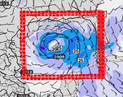
Later this weekend various models are hinting at a tropical storm forming in the southern half of the Gulf of Mexico. Other than that, models are in disagreement and all over the place regarding which way future “Debby” will be heading.

