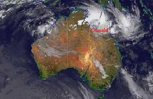
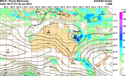
Oswald Brings Significant Rainfall to Queensland
Southern Australia’s heat wave came to an abrupt end this week thanks to a potent trough that made its way across its southern half. This trough ushered in cooler air and more reasonable highs can be expected with lows in the teens as opposed to the high twenties that they were experiencing last week.

However, a tropical disturbance, as predicted by the models last week has organised and brought much moisture to Queensland as it made its way south and transitioned into an extratropical storm. Formerly known as tropical storm Oswald, the extratropical storm has dumped over a metre of rain (1000mm) in some areas of Queensland causing for flash flooding concerns. As of Friday evening, 11 flood warnings were in effect (all in Queensland) as well as some wind warnings for the higher elevations and coastal areas. Peak gusts of 115km/h were recorded with Oswald’s passage. It appears as though residents were well prepared as not much damage was reported and only one rescue had to be executed off the coast.

The extratropical storm will get pushed out to sea ahead of the trough early next week giving way to calmer weather for Queensland. Areas of North-East Australia will remain under very warm conditions (over 40°C) through next week, combined with relative humidity below 20%. This could cause some bushfires and Fire Weather Warnings might have to be issued by the Bureau of Meteorology.
