Major Snowstorm Hits US Plains
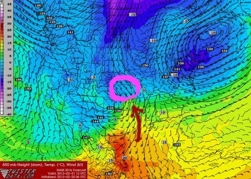
Another trough digging through the southern half of the US this past week, caused trouble for travellers and residents of the Great Plains. Moist air from the Gulf of Mexico made its way north into Kansas which fell as freezing rain and snow ahead of the warm front. In the warm sector a line of thunderstorms, some severe, formed along the trough line that plowed through part of Texas and Louisiana.

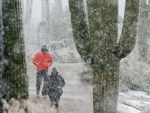
Highway conditions quickly deteriorated after snow started falling and 150km of I-70 had to be shut down in Kansas due to many vehicle accidents. This system also prompted the closure of schools, delayed flights at airports or even closed airports such as the Kansas City airport. This same trough is to be blamed for suspending play at the PGA in Marana, Arizona where an uncommon sight could be seen; snow – about 4cm of it, covered luscious greens with cacti nearby in the background.

Snowfall rates of 3-5cm/h were not uncommon for several hours in Kansas and Nebraska and contributed to significant snow accumulations. Highest accumulations were just below the two foot mark (60cm) in south-central Kansas with a good part of Kansas receiving over 20cm of snowfall. Most of the Southern Plains residents welcome any type of precipitation at this time however due to a severe/extreme drought is currently in place through much of the Plains (as talked about in last week’s EIWN). Last Thursday’s storm should at least make for slight improvements in the short term drought index but for longer range improvements the Plains need to get out of a persisting dry pattern.
Recent model runs show another major snowstorm, with as much as another foot of snow, Sunday night into Monday for the US Plains.
