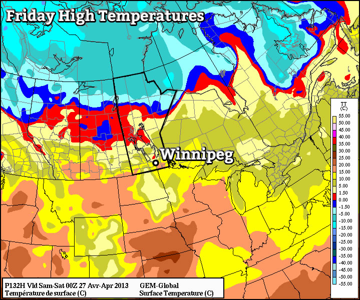
This week will start out well below normal, but there are signs that we may begin to warm up towards week’s end. Is Spring finally set to arrive?
Monday and Tuesday
Mix of sun and cloud. Chance of flurries.
-3°C / -8°C
Mainly sunny.
2°C / -8°C
Monday will be a cold day by April standards. High temperatures are generally not expected to exceed the freezing mark in Southern Manitoba (except in cities and forests), which will make the day some 15 degrees below our normal high of 13C. There may be some isolated flurries on Monday, as weak low-level instability develops during the day.
Tuesday will be a bit warmer than Monday, but not by much. Temperatures should climb just above zero in most areas, but that will still put as well below normal.
Wednesday
Mainly cloudy. Chance of flurries.
2°C / 2°C
Wednesday should be another above freezing day in Southern Manitoba, but we could see more snow as well. Flurries look to plague us for much of the day as the atmosphere once again destabilizes behind a passing weather system. Accumulations look to be minimal, but I doubt that will make the snow any more pleasant.
Long Range

There are signs that we may finally see a return to near normal or just below normal conditions by late this week or into the weekend. Models are in fairly good agreement that temperatures will rise up into the high single digits or low DOUBLE digits by later in the week/weekend. Of course we have seen forecasts like this fall apart before this spring, but hopefully this time things will be different.
