This past week featured a number of severe weather events across the Great Plains of the United States. At least 98 tornadoes had been reported since Monday as of Friday evening.

This series of days with severe thunderstorms and tornadoes was caused by similar atmospheric conditions to what was in place around the time of the Moore, OK tornado. These conditions revolve around four properties that forecasters look for when assessing the potential for thunderstorms, the properties being moisture, instability, shear, and a triggering mechanism. Over the past week copious amount of moisture were present over the US Plains, noted by very humid conditions at the surface. These hot and muggy conditions caused the lower atmosphere to become very unstable generating very high levels of instability. A large dip in the jet stream, called a longwave trough, came onshore from the Pacific Ocean earlier this week putting the plains under a strong jet stream causing wind shear. And finally a series of fronts and drylines offered triggering mechanisms for storms throughout the week. These four ingredients came together perfectly to generate many severe and indeed tornadic storms all over the United States.
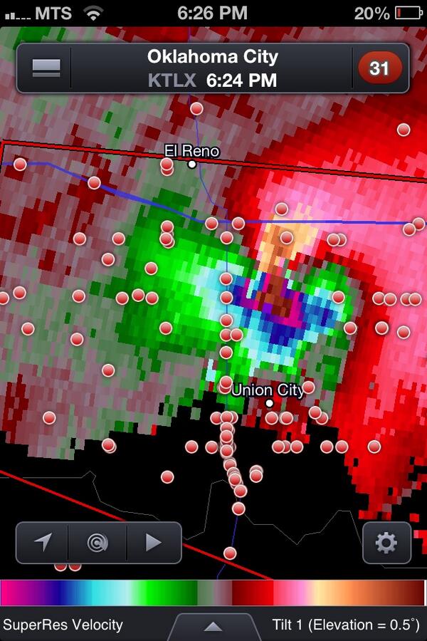
The week was capped (no pun intended) off on Friday by a complex of supercell thunderstorms that passed through Oklahoma City causing widespread damage and at least 5 deaths. The rotation in these thunderstorms (seen as the bright colour in the image above) has been referred to by many meteorologists as the strongest they have ever seen. In addition to several tornados touching down in the Oklahoma City Metro area, hail as large as softballs pelted down in some areas while nearly the entire OKC metro area received between 6 – 10” of rain causing widespread flooding with water as deep as 4’ in some places. Flash flood warnings continue this morning for much of eastern Oklahoma state with widespread overland flooding ongoing.
