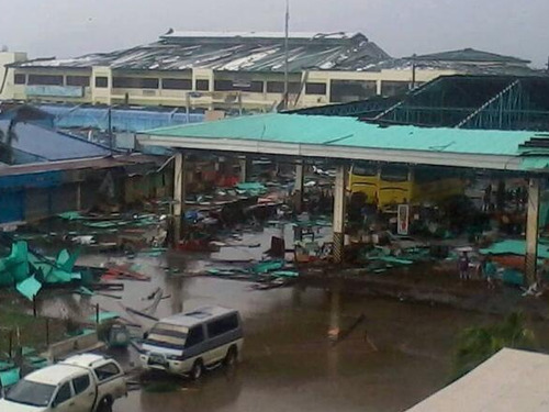
Super Typhoon Haiyan Plows into Philippines
One of the strongest storms ever recorded on the planet formed this week in the Western Pacific and eventually made landfall over the Philippines on Thursday. Early estimates from satellite data suggest that this super typhoon was the fourth strongest ever recorded and strongest to make landfall, since record keeping began.

Haiyan brought just about every type of severe weather you could experience with a typhoon; extremely strong winds with central pressure below 900mb, very heavy rains causing flooding and a powerful storm surge. The category five typhoon brought intense sustained winds in the order of 300km/h, gusting to over 350km/h and a storm surge of over 15 feet. Reports of damage are still coming in as of Friday night as communication to the islands hardest hit has been knocked out. Tacloban, a city of about 215,000 residents looks to be the hardest hit where damage is significant, storm surge swamped first and second floors of buildings and high winds tore apart buildings. It’s difficult to put an estimate on damage and death toll at this point.

Haiyan continues its trek this weekend as it moves over the South China Sea towards Vietnam. It is expected to make landfall on Saturday overnight as a category two typhoon. Haiyan’s passage over the Philippines weakened its inner core as well as slightly cooler sea surface temperatures and higher shear values have all contributed to Haiyan’s slow weakening. Regardless, the typhoon still needs to be watched closely as it approaches Vietnam as flooding and landslides are expected to be a big problem.
