Southern Ontario, Midsection of US Anticipate Ice Storm
A major ice storm has been taking shape as of Friday night across parts of Oklahoma and Texas and will continue to push northeast. A potent cold front with Arctic air filtering in behind it is clashing with gulf moisture moving north and thereby creating prime conditions for ice accumulation from Oklahoma all the way to southern Ontario. Dangerous travel conditions are expected as there could be significant ice accumulation due prolonged periods of freezing rain through this weekend. With this comes the possibility of downed power lines so residents have been made aware to prepare for power outages across southern Ontario. So overall, not ideal conditions for holiday travel this weekend as all kinds of precipitation will be falling across the eastern half of the US and southern Ontario.

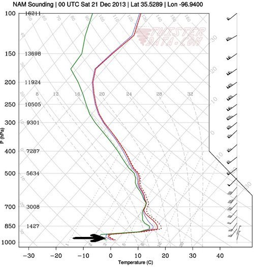
Freezing rain forms when there is a deep layer of warm air that is above freezing aloft. As the ice crystals fall and meet the warm layer, they melt and become raindrops while falling towards the ground. A shallow layer of cold air just above the surface of the earth must also be present for freezing rain to form. Supercooled water droplets – drops of liquid water that exist in below freezing air, will be in place and won’t have enough time to freeze into ice pellets, thus will freeze (as ice) on contact as they hit the ground.
In addition to this, a severe weather outbreak is expected in Dixie Alley of the US today. The outbreak is associated with the same system as the cold front slices through the warm, moist air mass in place. A moderate risk has been issued by the Storm Prediction Center as well as a 15% hatched area for tornadoes in Mississippi and northern Louisiana. Chances of tornadoes are quite high, the only possible limiting factor is that CAPE will be fairly low (only around 500-1000J/kg) but this will still be sufficient for supercells which will quickly evolve into a quasi-linear convective system – a line of severe thunderstorms that can have bowing segments. SPC gives fairly strong wording for today in Dixie Alley saying that “there is potential for several tornadoes – some of which should be strong”.
By Monday night the system will have moved off the US East Coast but will still be a weather-maker for Atlantic Canada.
