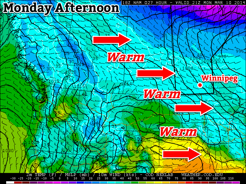
We’ll continue to see warm weather persist this week, but our snow won’t be disappearing any time soon.

Monday
Today will be one of the warmest days this week. High temperatures will edge above zero as a brisk westerly wind allows Pacific air to pour into Manitoba. Naturally, there will be some melting today, but it will do little to dent the massive snowpack in the region.
Tuesday
A high pressure system will slide down from the arctic on Tuesday, bringing a temporary return of chiller weather. It won’t be cold by any means, but it will be cool enough to halt the snow melt. There may be a few flurries around due to the presence of low cloud.
Wednesday
A strong southerly flow will develop in southern Manitoba on Wednesday, signaling a return to warmer conditions. Wednesday will be a fairly mild day, but those gusty south winds will make it feel quite a bit cooler than it would otherwise seem.
Long Range
The long range forecast is somewhat ambiguous at this point. Long-range weather prediction models are struggling to figure out what type of weather we’ll see for the rest of March. It appears the most likely outcome is an up and down pattern, with periods of mild weather followed by periods of colder weather. Thankfully, there is no sign of a return to the extreme cold we experienced at the beginning of the month.
