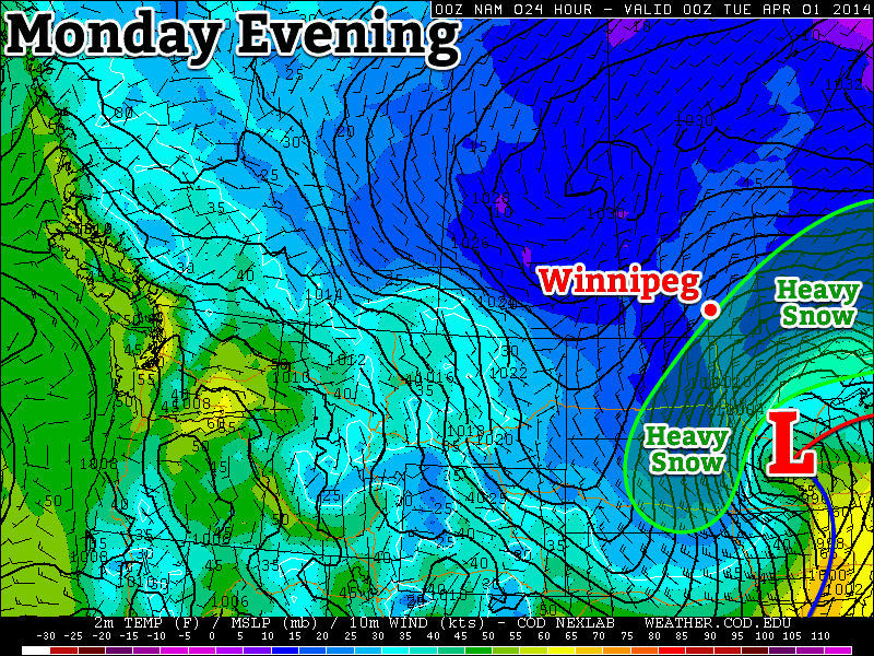
This March not only came in like a lion, it will also go out like a lion. A major winter storm will slam the American Red River Valley and parts of south-eastern Manitoba today. Read on for the details.

Monday
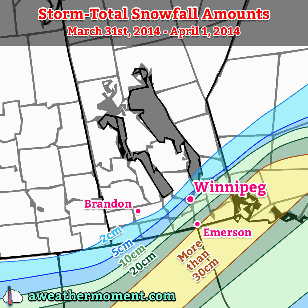
A Colorado Low will bring heavy snow and high winds to the Red River Valley and south-eastern Manitoba today. Wind speeds will range from 40-50km/h gusting to 50-70km/h. Some areas may even see winds as high as 60km/h gusting to 80km/h for a period of time. This will produce blizzard conditions in open areas of the Red River Valley and south-eastern Manitoba. The map below illustrates the expected snowfall totals.

Travel will become very difficult, if not impossible from points south of Winnipeg and into the American Red River Valley as the day progresses. Highway closures are likely through the day, with some roadways possibly staying closed until Tuesday. Roads that remain open will be in poor shape as well, so those traveling today may need to reconsider their plans.
This storm will wind down on Tuesday as the snow ends and the wind begins to decrease. However, those areas that saw the heaviest snow will have to deal with large snow drifts on Tuesday. Travel will be difficult if not impossible, particularly in the American Red River Valley, on most of Monday and likely into Tuesday as well. Luckily this storm should signal the beginning of the end of the seemingly endless winter we’ve endured.
Tuesday
Tuesday will be a much calmer day in southern Manitoba. Temperatures will warm into the minus single digits, but a north-west wind will linger as Monday’s storm departs. At least it will be decent shoveling weather…
Wednesday
Wednesday will see further improvement over Tuesday, as temperatures climb into the low to mid minus single digits. That should be good enough for some light melting of snow off dark surfaces – melting that can’t come soon enough for most people.
Long Range
The long range forecast is looking good for a change. Most models suggest we’ll see near normal weather in the short to medium term, which means high temperatures in the mid positive single digits. That should help to gradually start wearing down our snow pack.
