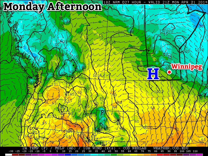
For the first time in a long time we’re in for an extend period of mild weather, sounds nice doesn’t it!

Monday
Today will feature slightly below seasonal temperatures in southern Manitoba. Highs will range from the low teens in south-western areas, to upper single digits in the Winnipeg region. We’ll be under a surface ridge of high pressure, which should keep winds relatively light and skies relatively clear.
Tuesday
Tuesday looks to be another nice day in southern Manitoba. Temperatures should be near to slightly above-seasonal, meaning high temperatures in the low to mid teens. The wind will begin to increase late in the day, particularly over western Manitoba, as a developing weather system approaches the region.
Wednesday
Wednesday will see mild weather continue, with temperatures in the upper single digits, although we may get a bit wet. That developing weather system noted for Tuesday will spread rain, or even snow, into Manitoba on Wednesday. It’s too early to say where the main impacts of this storm will be, but it looks to become a fairly major storm for some part of Manitoba. Some of the current models take the storm up into Central Manitoba, while others take it through southern Manitoba. Areas to the north of its track could potentially see heavy snow, while areas to the south will see rain. As more certain information about this storm is available, we’ll be sure to let you know.
Long Range
The long range forecast suggests we’ll generally see normal to slightly-below normal weather to close out the month of April. That means high temperatures generally near the 10°C mark. While 10°C is nothing spectacular for this time of year, it certainly sounds ok given how awful the last several months have been.
