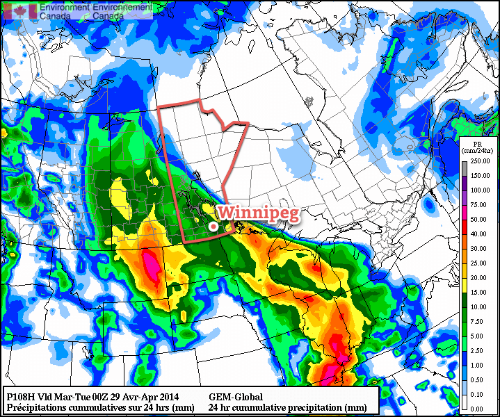
This weekend will bring a brief reprieve from the wet weather before a Colorado Low begins impacting the region for the start of next week. Temperatures will remain below normal, but we should see plenty of sunshine with just relatively light south-easterly winds.
Today will bring mostly cloudy skies with a chance for some lingering showers or drizzle as the system that’s been impacting us over the past few days slides off into Ontario. Clouds will begin to break up a bit in the afternoon as we head towards our high of around 8°C, however it won’t be until the evening or overnight period until we see the clouds actually begin to clear out.
Saturday look like the nicest day of the next few, with more sun than cloud and a high near 10 or 11°C. The wind will be out of the southeast at around 20-30km/h, but otherwise it’ll be a pleasant – albeit cooler than normal – spring day. We’ll drop to around 2 or 3°C on Saturday night under mainly clear skies.
Sunday will herald the arrival of the next storm to impact the Prairies: a massive Colorado Low that looks to stall out over the northern Plains of the United States and absolutely smother the Prairies in precipitation.

This system looks to be extremely complex with multiple features interacting with each other: the Colorado Low itself, a large inverted trough that looks to develop along a north/south line through Saskatchewan, and the occlusion of the upper-level low centre that will stall the system out over the Northern Plains. Subtle variations in any one of these features can dramatically alter the weather outcome, let alone how those variations will interact with each other across these features. In addition, there will be a fairly significant high pressure system through Northern Manitoba that will surely do it’s best to inject dry air into the system and really sharpen up the northern edge of it. Needless to say, we’ll be keeping a close eye on this one and have more details on where, and how much, precipitation might actually happen in the comments below as things begin to come together.
