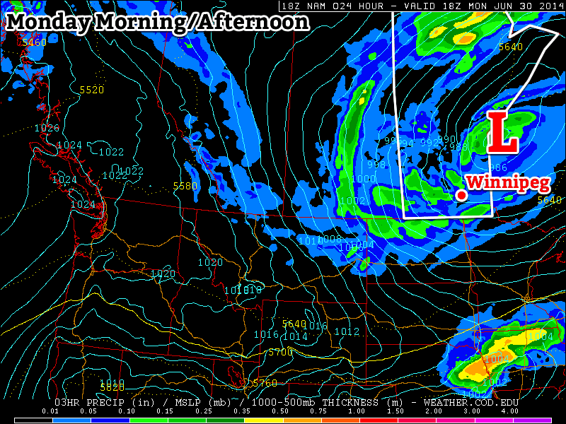
We’ll have to endure another couple days of miserable, cool, and rainy weather before conditions finally turn more summer-like again.

Monday
Today will be another nasty day in southern Manitoba. The large low pressure system that has been affecting us since Saturday will continue to produce rain today. The intensity of the rain will not be as high as what we saw on the weekend, but many areas could see an additional 5-10mm through the day, with locally higher amounts. It will remain windy as well, with a west to north-west wind at 30km/h gusting to 50km/h.
Tuesday
Showery and cool weather will just keep coming on Tuesday. Luckily, it appears significant accumulating rain should be over by this point, with just the odd light shower remaining. However, temperatures will be well below seasonal and it will be windy again. Overall, another nasty day.
Wednesday
It looks like we’ll finally see a break in the weather on Wednesday, as high pressure moves in and skies clear out. Temperatures should be in the low twenties under sunny skies and light winds. It will be a nice day, even if it is still a bit below seasonal for this time of year.
Long Range
Fortunately, given the weather of late, the long range forecast is looking encouraging. Models suggest that we’ll see a warming trend late this week into the weekend. At least for the time being there is no indication of another cool-down in the forecast.
