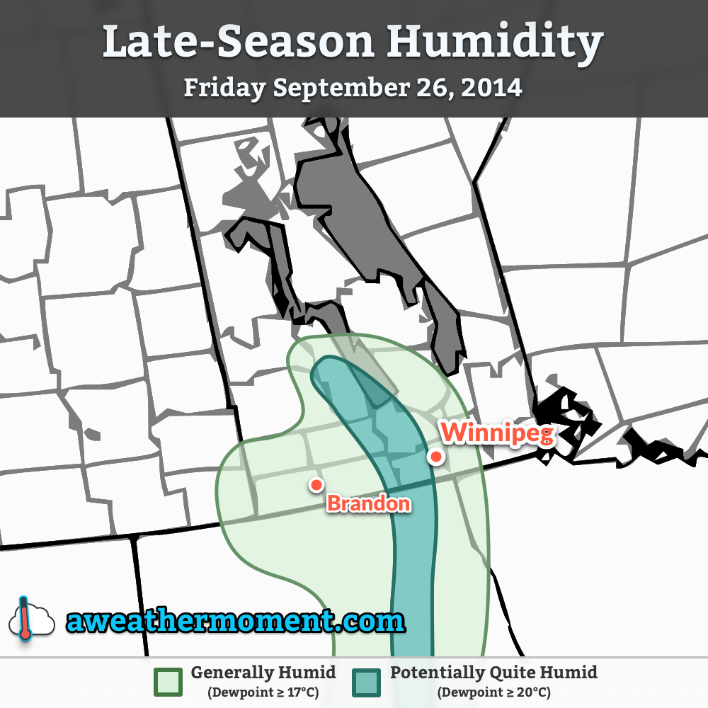
Temperatures will remain well above normal for two more days before seasonal air begins pushing back into the province through the weekend as a cold front gradually progresses southeastwards. A chance for showers returns to southern Manitoba on Sunday as a disturbance developing in North Dakota causes the cold front to stall out over our area.
First the good news: after we burn off a little fog that developed overnight, today will be another beautiful, summer-like day with highs in the upper 20’s and surprisingly humid conditions for late September. Strong southerly winds at 40–50km/h with gusts as high as 70km/h will be tapping into a pool of moisture in the Northern Plains and drawing it northwards. Dewpoint values will sit near 17–19°C through much of the southern portions of the province.

Yesterday I erroneously tweeted that our dewpoint of 17.6°C broke the previous record of 16.8°C set in 2008 and that it had been the latest on record[1] such high humidity had been seen in Winnipeg. Rob’s Obs did a little digging and found that the actual record is still held by October 8, 1997 when the dewpoint climbed to 18.6°C. Whoops. I apologize for missing that.
That being said, today will give that record a run for its money; multiple models forecast our dewpoint to climb to 19°C, which if it happens would be the latest 19°C dewpoint on record.
Saturday will be a beautiful day in Winnipeg with a high in the mid–20’s and more comfortable humidity as a cold front gradually approaching begins flushing out some of the moisture in the region. There’s a chance of fog again in the morning and we may see a few clouds around, but the bulk of the day should be mainly sunny. Winds don’t look to be an issue.

Things change on Sunday as the cold front that was approaching on Saturday stalls out as a disturbance in North Dakota develops. A band of rain is expected to develop along the stalled out front, spreading from SW Manitoba eastwards through the afternoon until a band of rain stretches across the whole province. Temperatures will start off cool and only drop from there as the rain cools things off a little further and northerly winds at 20–30km/h continue to tap cooler air and bring it into the region. The rain should taper off late in the evening here in Winnipeg with anywhere from 5–15mm falling depending on the exact timing and speed of the system. Temperatures will dip down to around 6°C.
Unsettled Week Ahead Leading to A Cold Snap
Long-range forecasts don’t look particularly great. The first couple days of the week look seasonal temperature-wise. A series of Colorado Lows look to develop mid-to-late week which will bring a chance for showers, but more significantly, begin drawing down much cooler air from the Arctic. The end of the week looks like it will end with an Arctic outbreak bringing another shot of below-normal temperatures and brisk northwesterly winds.
- Records for seasonal dewpoint values go start in 1953. ↩
