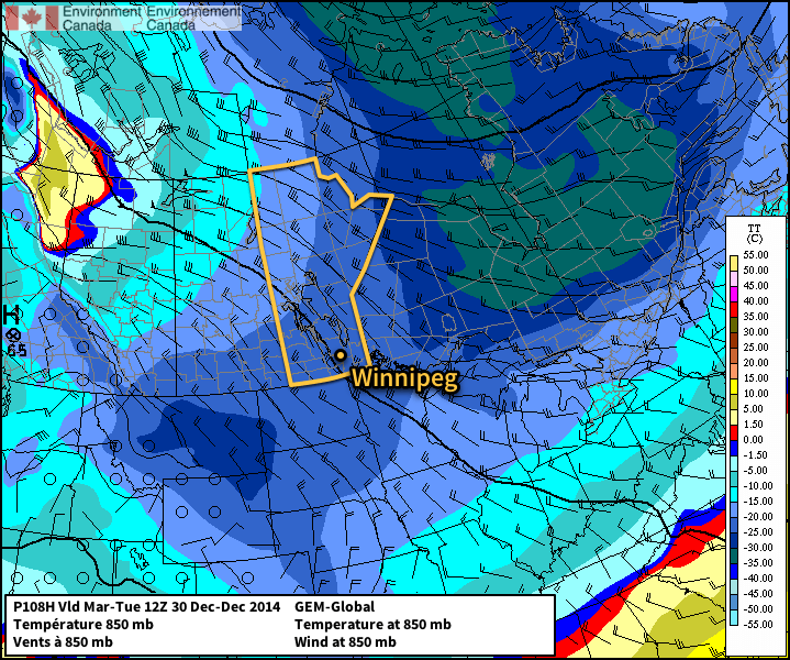
As we mentioned on Wednesday, a big cool-down is underway across Southern Manitoba. While we knew earlier that it was going to get cold[1], it’s beginning to become clear that it’s going to get quite a bit colder than that. Just how cold? Winnipeg might see daytime highs in the near future not seen since last January.
Today will be the coolest day in a little over a week as temperatures will slide towards –13°C by the end of the day. Skies will start out cloudy then gradually become more mixed through the day. With favourable temperature profiles, some patchy non-accumulating light snow is possible. Winds will be out of the northwest at around 15–20km/h. Temperatures will drop to near –17°C tonight.
Daytime highs will drop on Saturday to just –16 or –15°C with mixed skies. Some flurries or light snow is expected as a system slides from Saskatchewan into North Dakota, but amounts aren’t expected to be much more than a skiff at most. Temperatures will drop into the mid-minus 20’s on Saturday night.
Sunday will be a downright cold day a few clouds around. Highs will sit near –20°C through the Red River Valley and winds will be light. Expect lows dipping close to –30°C on Sunday night.
Cold Start to Next Week

Next week will begin with a substantial trough of cold air positioned over Southern Manitoba that will bring daytime highs in the mid-minus 20’s through the first half of the week. There may be a mid-week warm-up, but a return to colder weather would follow quickly behind. No big storms are on the horizon, so in general expect cold, dry weather to persist through the next week.
- On Wednesday’s post, we surmised that daytime highs would generally be near –20°C. ↩
