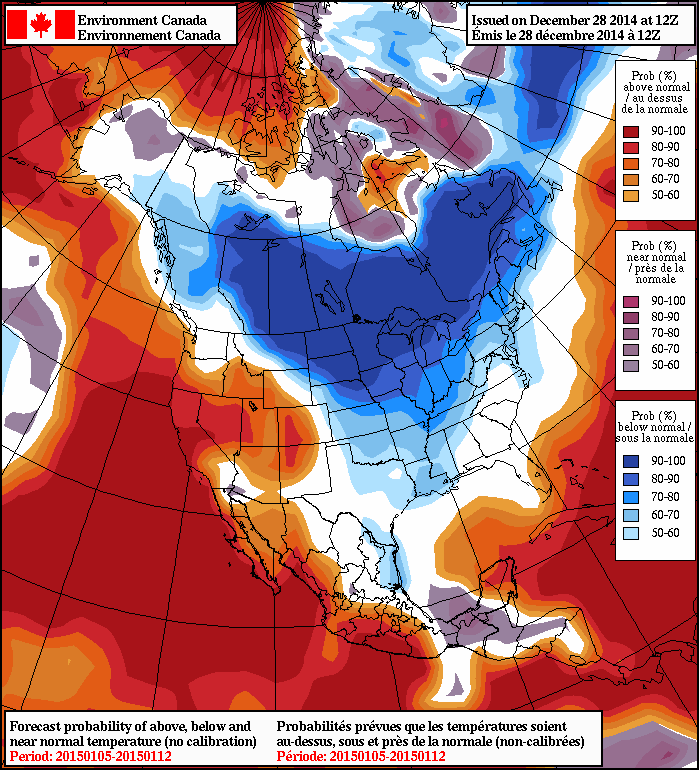
A strong Arctic ridge has brought the coldest weather so far this winter into the province. Temperatures will be well below seasonal[1] for much of the coming week.
Today’s post will be a relatively brief one since there simply isn’t much weather to talk about. Today and tomorrow will both be very cold days with highs not even hitting –20°C under mainly sunny skies. Tonight will bring lows dipping below the –30°C mark and winds at 10–15km/h creating wind chill values near or just below –40.[2] Tomorrow night will be quite a bit different, though, as an approaching low pressure system brings increasing cloud and climbing temperatures. By Wednesday morning, skies should be mixed to mainly cloudy with temperatures near –18°C. Through the remainder of Wednesday we should continue to see mixed to cloudy skies with temperatures climbing to around –12 or –11°C. There’s a slight chance for some flurry activity, but in general temperatures look a bit on the cool side for the kind of snow that would be possible. Skies clear on Wednesday night as temperatures drop into the –20 to –25°C range.
New Year, Same Story
Despite the promise of a new year beginning on Thursday, the story will be one we’ve heard before: a return to the deep freeze.

Another shot of bitterly cold Arctic air will begin working its way into the Prairies through the latter half of the week, with daytime highs dropping from the low minus teens into the –20 to –25°C range by the weekend. Overnight lows will follow suit, also dropping through the week and likely dipping below –30°C by the weekend. Little to no snow is expected. The exceptionally cold weather is expected to persist into next week.
