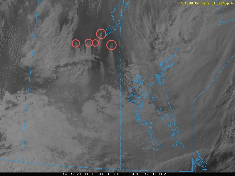
This week will see relatively benign weather, but unfortunately also the continuation of forest fire smoke over southern Manitoba. A persistent west to north-west flow aloft will continue to transport smoke from northern Saskatchewan into southern Manitoba.
Monday
Today will see cool conditions in southern Manitoba as a chilly air mass surges down from the arctic. High temperatures are only expected to be in the mid teens, but skies will be mainly sunny. Surface winds will be breezy from the north.
Tuesday
Tuesday will see somewhat warmer conditions from Monday as some warmer air begins to return from the south-west. High temperatures should reach the low to mid twenties under mainly sunny skies. The only unknown in Tuesday’s forecast is how extensive forest fire smoke will be over the region. Should smoke be quite extensive, temperatures will likely stay closer to 20C, whereas less smoky skies will promote temperatures in the mid twenties. Our forecast is a compromise position between these two possibilities.
Wednesday
Temperatures are expected to remain near to slightly below seasonal for Wednesday, with highs in the low to mid twenties. There is a decent chance of showers or thunderstorms during the day as some mid-level instability develops in the atmosphere. Severe storms are not expected, but do not be surprised to hear some thunder!
