Temperatures will be returning to more summer-like values through the second half of this week thanks to an upper-level ridge that will push out the cold air drawn southwards behind this past weekend’s big storm and allow more heat to begin building into the region.
The coming two days will be gorgeous with plenty of sunshine, light winds and warm temperatures. Today will see daytime highs near 26 or 27°C while Thursday will bring highs a degree or two warmer. Overnight lows both nights will be near 12°C. The most significant weather feature will be the significant amounts of smoke that will be pushing into the region sourced from wildfires raging in the northwestern United States. At this point, it seems like it should mainly be aloft and not pose much of an air quality issue.

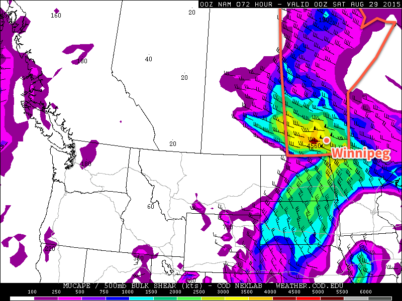
Friday will see a low pressure system moving through the region, bringing warmer temperatures alongside a thunderstorm threat. The major question mark, at this point, appears to be whether or not any smoke in the region inhibits temperatures from climbing high enough to trigger thunderstorms or not. That said, it looks like the potential will be in place for severe thunderstorms with over 3000 J/kg of CAPE expected and over 50 kt of bulk shear in place.
We’ll be taking a closer look at the severe thunderstorm potential on Friday morning in the next blog post, but for now, just keep aware that the threat for severe weather may return to the Red River Valley on Friday.
Other than the storm potential, daytime highs should sit near 30°C with mixed skies. There’s also a reasonable chance that it will be quite humid, making it feel more like the upper 30’s.
Heading through the weekend, it looks like Winnipeg & the Red River Valley will see highs near 30°C with plenty of sunshine, making up for the miserable weather during the last weekend. Other than the blip on Friday, there’s plenty of warm, dry and sunny weather ahead, so enjoy!
