After a pleasant, summer-like start to the week, the weather is set to turn more unsettled as a disturbance rolls through Southern Manitoba tonight. Fortunately, the agitated weather will only bring temperatures back towards seasonal values before we see the heat move back in through the weekend, setting Winnipeg & the Red River Valley up for a hot start to next week.
Today will be a fairly pleasant day in the Red River Valley. There’s a slight chance of some shower activity early this morning as a trough passes through the region, but afterwards we’ll see the cloud begin to clear out through the remainder of the morning leading to just a few clouds this afternoon through the region. Daytime highs will climb to around 21°C–but with significantly less humidity than yesterday–with winds initially out of the northwest at 20–30km/h tapering off through the morning.
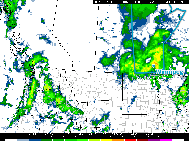
The more significant weather will roll into the province this evening as a low pressure system lifts northeastwards out of North Dakota and pushes across southern Manitoba. An area of showers, likely with thunderstorms embedded, will develop across southern Saskatchewan and northeastern Montana and spread eastwards through the night, pushing into southwestern Manitoba early in the evening and then spreading into the Red River Valley and Interlake through the remainder of the night. As is typical with systems that involve convection through the night-time hours, model solutions are a little scatter-shot as to what the outcome will be. Overall, it appears that the bulk of the precipitation will pass to the north of Winnipeg, however some models are coming up with solutions that bring significantly more precipitation into the region.

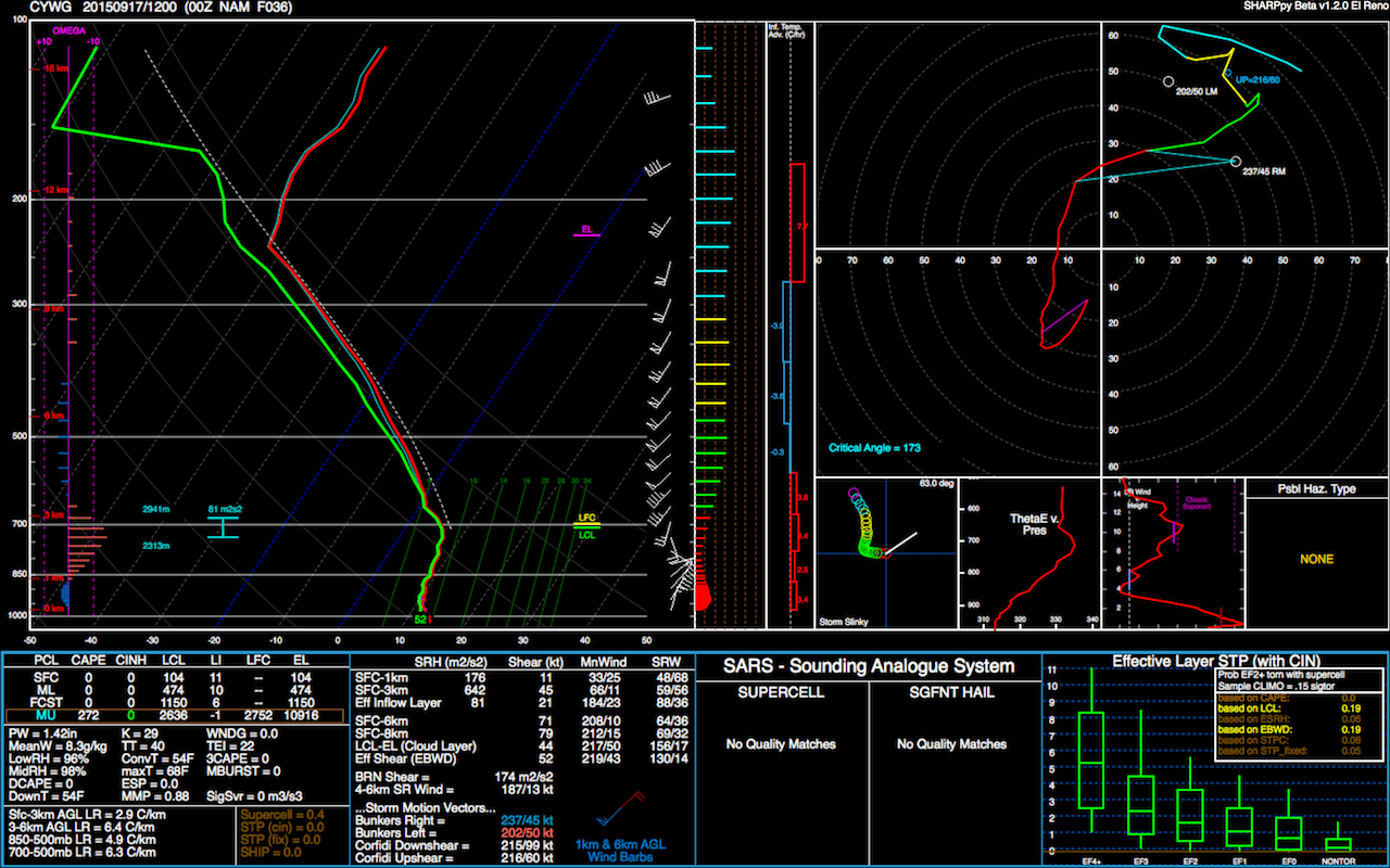
The NAM-based solutions all tend to produce fairly strong, convectively-driven rainfall over the Red River Valley late tonight into Thursday morning. With PWAT[1] values near 35mm, the rainfall could be quite intense, however strong winds aloft should be moving anything that develops along at a fairly decent clip, meaning overall rainfall accumulations shouldn’t be excessive with around 10–20mm in any heavier precipitation that develops. Outside of thunderstorms/heavy rain cells, the more general rainfall amounts from this system should be around 2–5mm or so in regions south of the Trans-Canada Highway, and closer to the 5–10mm range for areas northwards.

Temperatures will dip to around 14°C tonight. Thursday will see a high near 15°C with winds increasing out of the northwest to 40 gusting 60km/h in the afternoon. A chance for showers will persist through the remainder of Thursday under mainly cloudy skies.
Friday will bring calmer weather to the region with mainly sunny skies and a high near 19°C. Winds shouldn’t be too bad at around 15–20km/h.
Warmer Weather Returns on the Weekend
Our cool-down to seasonal temperatures will be short-lived, however, as warmer weather is set to build back into Manitoba through the weekend. The upper-level trough that will bring us our unsettled weather will push off to the east and a zonal flow is forecast to quickly develop across the Prairies, pushing in warmer air aloft that will begin to bump our temperatures back upwards. Saturday looks to have a high around 20°C, while Sunday will see the mercury climb towards the mid–20’s.

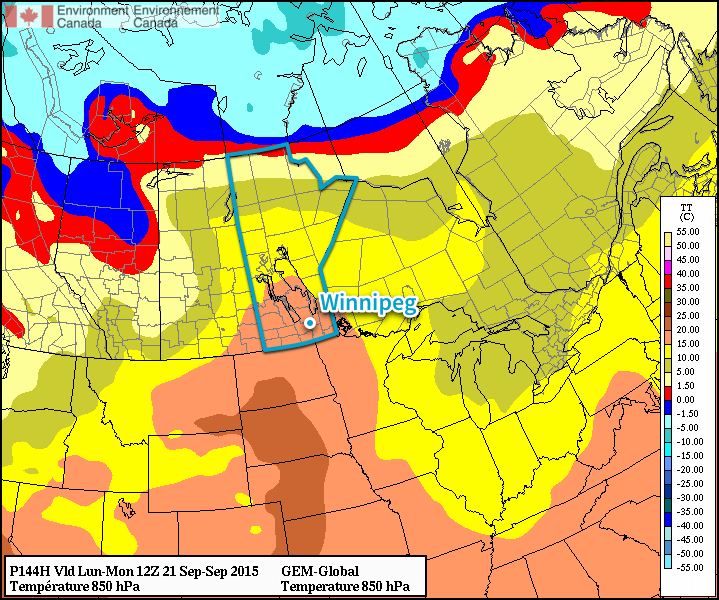
The GPDS is forecasting 850mb temperatures pushing into the upper teens through Monday, which would equate to temperatures in the upper 20’s as long as we see the sunshine. Afterwards, it looks like we may see a couple more disturbances roll through in the remainder of the week, bringing temperatures back towards seasonal.
While we will have occasional cool-downs, long-range forecasts continue to forecast above-normal temperatures through the remainder of September.
- Precipitable Water ↩
