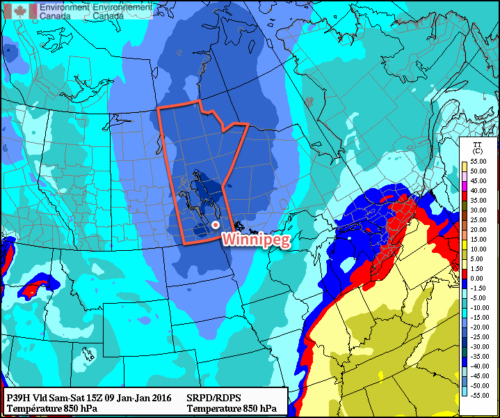
Winnipeg will see some of the coldest weather of the winter as Manitoba falls under the influence of the infamous Polar Vortex. Unlike other brief cold snaps seen this winter, this cold spell looks to be rather persistent, with only one brief warm-up on the horizon before the Arctic air returns.
Today will start with a few remaining flurries pushing out of the region as a cold front sweeps through the province. Winds will be out of the northwest at 20-30km/h for much of the day. Once the flurries move out this morning, the Red River Valley will be left with mainly cloudy skies and falling temperatures. By late this afternoon, the temperature will sit around -18 or -19°C.
Skies will remain fairly cloudy tonight as temperatures dip to -26°C.

Saturday will mark the full arrival of the Arctic air. The high temperature will be limited to only -21°C with light northwesterly to westerly winds. There’s some uncertainty as to how much cloud cover will remain in the area, but it appears that we’ll likely see mixed skies here in Winnipeg. A little bit of clearing will move in on Saturday night as temperatures dip to around -25°C.
Sunday will continue the cold trend with daytime highs near -20°C under partly cloudy skies and light south to southwesterly winds. Sunday night will continue seeing partly cloudy skies with a low near -25°C.
Weather Roller Coaster Next Week
Unfortunately, next week doesn’t look to offer too much of a reprieve from the cold. This outbreak of colder weather has been driven by a weakening of the Arctic Oscillation (AO) which has allowed colder air to spill southwards. Despite the strong El Niño, the reality often is that cold air is king, and it’s managed to shunt out the warm air. The coming week will be a battleground between the blocking pattern of the Polar Vortex and the attempt for a more typical El Niño pattern featuring warmer weather and a more progressive pattern.
The first half of next week looks fairly cool with daytime highs in the -15 to -20°C range and a slight chance of snow on Monday into Monday night. There is hope for a more substantial warm-up mid-week, however.
A surge of significantly warmer air is expected to spread eastwards on Tuesday with some light snow associated with it. General consensus is that an Alberta Clipper will develop over Northern Alberta and then race southeastwards along the baroclinic zone, flattening it out and sweeping cold air southwards in its wake.
Exactly how warm it manages to get in Winnipeg will depend substantially on the timing and exact location of the setup. Some forecasts show the warm air fully pushing into the region and resulting in daytime highs mid-week near -8°C, while others have a more southerly track and occlude the warm air out to the south quickly and keep temperatures fairly cold.
After the passage of the clipper and any associated snow, the Polar Vortex is expected to retrogress and usher another shot of very cold air into Manitoba.

So it’s a bit sunnier than expected this morning–in that it’s completely sunny and not cloudy at all–but it will be short-lived. Overnight, a small gap opened up between the back edge of the cold front and the main deck of stratus cloud. Over the next 2-3 hours, the cloudy conditions we are expecting will spread southeastwards over the Red River Valley and persist for much of the day.
Alongside the cloud, many sites upstream are reporting some light flurry activity, so we’ll likely see that in Winnipeg as well. The snow will be lighter than what we received overnight and will have no significant accumulation.
Hey, it’s not really that cold. -25C is really nothing. -35, now THAT’s cold, and not that unusual for this time of the year.