This week will start out mild, with temperatures just below the freezing mark. However, colder weather appears to be on the way for the weekend.
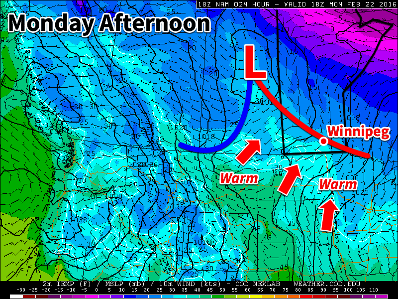
Today will be mainly cloudy with some flurry activity. A low pressure system to our north will push southward during the day, ushering in this light snowfall. We’ll be in the warm sector of this low pressure system, allowing us to experience mild temperatures just below the freezing mark. Winds will also be light, making for a generally nice day.

Tuesday will remain mild, although temperatures will dip slightly in the northerly flow behind Monday’s system. A few flurries may persist on Tuesday, though no significant accumulations are expected. Winds will be breezy from the north at 20-30km/h.
Wednesday will see the continuation of mainly cloudy, but mild conditions. Temperatures will remain just below the freezing mark with flurries likely again. Winds will be light however, making for a grey, but generally decent day.
Long Range
The long range forecast suggests that mild weather will stick around through the remainder of the work-week. However, it appears another arctic blast is on tap for the weekend, bringing temperatures well below normal. Models suggest that this arctic air mass will stick around into next week, although it will be tough for extreme cold conditions to persist as we push into March.
Winnipeg’s seasonal daytime high is currently -6°C while the seasonal overnight low is -17°C.
