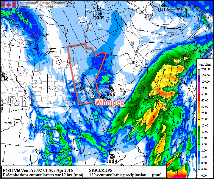
A major shift in the overall weather pattern will bring a blast of Arctic air to Winnipeg for the end of the week, ushered in by unpleasant and strong northerly winds and the now-infamous Polar Vortex. Fortunately, the cold snap looks to be short-lived as the coldest air will rotate off towards Eastern Canada quickly and near-seasonal temperatures return early next week.
Today will remain pleasant with above-seasonal warmth in place as temperatures climb to around the 9°C mark for Winnipeg’s daytime high. Skies will start off sunny, but become mixed through the afternoon as cloud begins spreading in ahead of a low pressure system that will impact the province later today and tomorrow. Showers and flurries will push into western Manitoba this afternoon, but will remain west of the Red River Valley for the most part until tomorrow.
Here in Winnipeg, skies will be cloudy tonight as the temperature drops to a low near 0°C.

Thursday will be mainly cloudy with a chance of showers or flurries throughout much of the day. The first of two cold fronts will swing through in the afternoon, ushering in strong northerly winds of 40 gusting 60 km/h. Temperatures will climb to 4-5°C for the daytime high, but much cooler air will work into the region tonight, sending overnight lows to around -8°C.
Friday will also bring cloudy skies with a high near +2°C as another low pressure system moves through brining a decent chance for some more snowfall through the afternoon/evening. Behind the system, another shot of strong northerly winds, this time as strong as 50 gusting to 70 km/h. Temperatures will fall to a low near -10°C on Friday night.
Long Range
The weekend will be cool with below-normal temperatures as the Polar Vortex grazes Manitoba as it rotates eastwards into Ontario.
The Polar Vortex is easily seen by abnormal 500 mb heights (pictured above over Ontario in pink/purple) and will bring below-normal temperatures to much of Manitoba throughout the weekend with daytime highs near the freezing mark. Alongside the cool weather will also come mainly cloudy skies, but no precipitation is expected.
Temperatures will rebound back towards seasonal next week with precipitation confined to a weak disturbance mid-week that could potentially bring a couple cm of snow or few mm of rain, depending on temperatures & timing.
Winnipeg’s seasonal daytime high is currently 5°C while the seasonal overnight low is -6°C.


