The quiet weather Winnipeg has seen over the past several days will continue with dry conditions and near-seasonal temperatures continuing to the end of April.
The forecast for the remainder of the work week is brief! "More of the same" will be the mantra for Winnipeg over the coming days with daytime highs in the low teens and variable cloudiness. Today will bring just a few clouds to the Winnipeg region with breezy winds out of the northeast that strengthen to around 30km/h midday and persist into the evening. Tomorrow will bring more of a mixed sky with lighter winds, and Friday is looking like it will be a mainly cloudy day with light winds.
All three days will bring daytime highs in the 12-15°C range and overnight lows from 1-4°C.

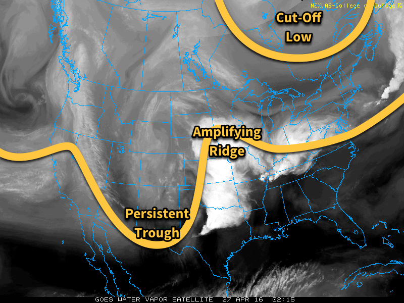
This stagnant weather pattern over the region has been due to a stationary trough over the central United States coupled with a cut-off low over eastern Canada. As we head through the coming days, the trough over the US is will amplify and cut-off, becoming stagnant over the Northern Plains while the ridge builds in response, to the the point where it pushes all the way northwest into Manitoba.
This all means the overall pattern can’t change very much, and we see more of the same. The earliest indication of the potential for change is early next week when, if things turn out as forecast, an upper-level ridge may begin building in over North America, spreading above-normal temperatures through the Prairies.
Winnipeg’s seasonal daytime high is currently 15°C while the seasonal overnight low is 2°C.
