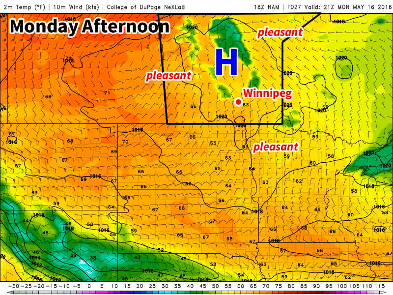
This week will feature a return sunny skies and warm temperatures, weather that we haven’t seen a lot of over the last week.

This Week
Today will be one of the cooler days this because we’ll still be in the coolish air mass leftover from the surge of arctic air late last week. However, high temperatures will still be in the upper teens under mainly sunny skies. Winds will be from the north as we’ll still be on the western edge of an upper trough, but the wind should shift to a southerly component on Monday night.
Tuesday will see even warmer conditions as temperatures climb into the low twenties. An upper ridge will begin building over southern Manitoba, which means Tuesday will be the first of many seasonably warm days. Winds will be light on Tuesday and skies are expected to remain sunny.
The forecast for Wednesday is a bit more uncertain than Monday and Tuesday because a shortwave trough is expected to push through southern Manitoba. It doesn’t appear this trough will bring any rain to southern Manitoba, but it may bring additional cloud cover to the region. Assuming the cloud cover isn’t too extensive, temperatures should climb into the mid-twenties with breezy south winds.
Long Range
The long range forecast suggests that the remainder of May will generally remain warmer than normal. One interesting feature of the long range forecast that bears watching is the potential for our first notable thunderstorm event of the year. Models have been consistent in bringing a large upper trough into western North America by next weekend, which is expected to draw a warm, moist air mass into southern Manitoba. The exact nature of the thunderstorm threat for southern Manitoba remains quite uncertain, but it appears possible we may see our first thunderstorm event of the year at some point on the long weekend.
