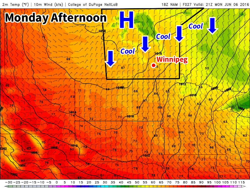
We’ll have a couple days of cool weather before an upper ridge builds in, bringing hot & humid weather to southern Manitoba in the second half of the week. The arrival of the heat and humidity is also expected to bring our first significant risk of severe thunderstorms this year.

This Week
Today will remain on the cool side as a surface high to our north-west pumps cool air into southern Manitoba. Some cloud cover is expected in southern Manitoba during the morning as an upper disturbance moves through, but skies should clear by the afternoon. Daytime highs will be in the upper teens with gusty north winds at 40 km/h gusting to 60 km/h.
Tuesday will remain cool as we remain under the influence of that surface high. Temperatures will once again be in the upper teens, although some areas in western Manitoba may reach the low twenties. Skies are expected to be mainly sunny and winds will be breezy from the north.
Warmer weather will begin to move into southern Manitoba on Wednesday as the surface high moves off to the east. A southerly flow will be in place over southern Manitoba, helping to bring warmer air into the region and push daytime highs into the mid twenties over the Red River Valley and the upper twenties over western Manitoba. There will likely be a risk of severe thunderstorms in eastern Saskatchewan on Wednesday and that may spill over into western Manitoba. Depending on how conditions develop, the thunderstorm risk may extend across all of southern Manitoba on Wednesday night as storms from Wednesday evening move east with time. A westerly steering flow and a strong southerly low-level jet would tend to favour easterly or south-easterly storm motions, which would help steer storms toward the Red River Valley during the overnight period. More details on Wednesday’s potential thunderstorm risk will be available as the week progresses.
Long Range
The long range forecast suggests a hot, but unsettled pattern, will be in place for southern Manitoba from late this week into the weekend. An upper ridge will be centred over southern Manitoba during this time period, but we are expected to remain at the top of this ridge, putting us along the storm track. The influx of warm, humid air due to the southerly flow in this ridge combined with the moderate to strong flow with the jet stream aloft should favour numerous thunderstorm chances during the Wednesday-Monday period. The nature of the thunderstorm threat remains quite unclear, but at least one or two severe events seems probable at this time. An upper trough is expected to approach either late this weekend or next week, which will push out this hot/humid air mass.
