Near-seasonal temperatures will be in place this weekend with just a chance of a shower or two across the Red River Valley as a few weak upper disturbances ripple through.
Winnipeg & the Red River Valley will see a beautiful day today with plenty of sunshine, light winds and a high near 24°C. There will be a very slight chance of a shower or two in the Red River Valley, but these will likely be confined to the extreme western portions of the valley, particularly close to the escarpment.
Skies will continue fairly clear tonight with a low near 13°C.
Saturday will bring more pleasant conditions to Winnipeg & the Red River Valley, although there will be slightly more cloud and an incrementally higher chance of some scattered showers throughout the valley, particularly through the afternoon hours. Temperatures will climb to a high near 25°C with light winds once again.
Expect a low near 14°C on Saturday night with partly cloudy skies.

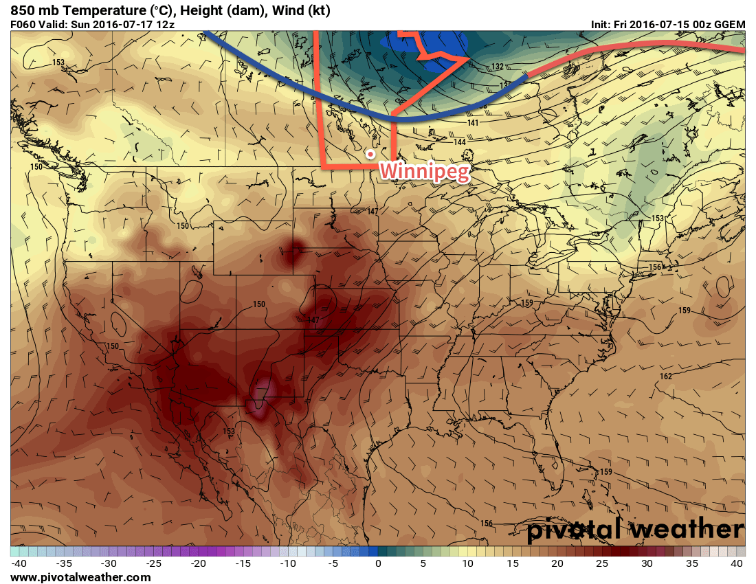
A weak cold front will sweep into the Red River Valley on Sunday, almost certainly bringing some precipitation with it. Temperatures will still be mild with a high near 25°C, however skies will become mixed to mainly cloudy in the morning, with scattered showers developing by midday. There will be enough instability to produce a thunderstorm threat, but at this time no organized severe thunderstorm threat is expected.1 Winds will shift from 15-25km/h out of the southwest ahead of the cold front in the morning to about the same speed out of the northwest behind the cold front.
Temperatures will dip to a low near 13°C on Sunday night with clearing skies and diminishing winds.
Next Week Brings the Heat
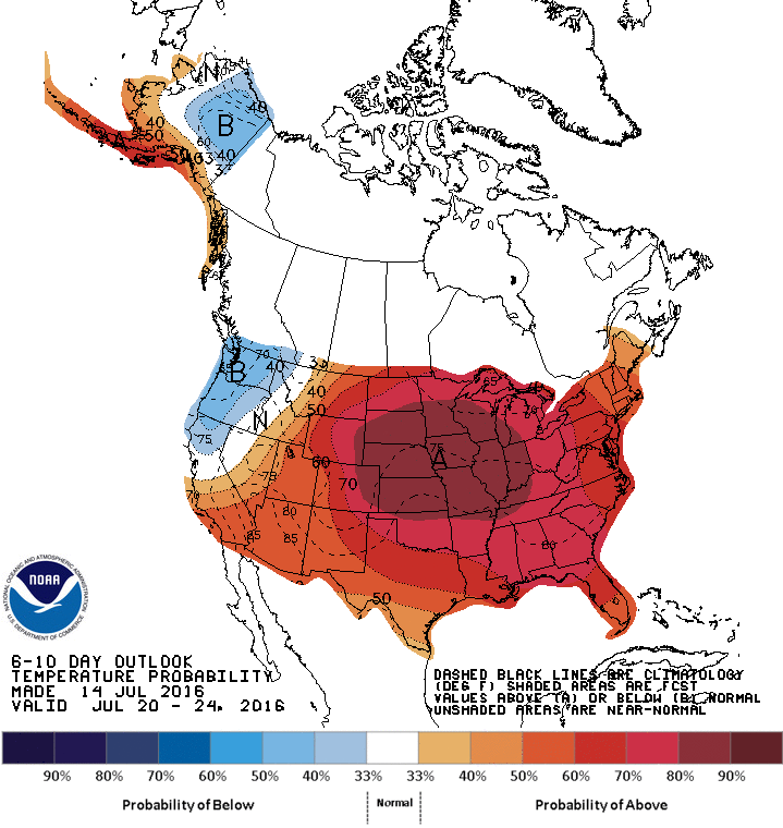
Heading into next week it's beginning to look like a bit of a mixed bag: we'll definitely be seeing a prolonged stretch of summer-like heat as daytime highs climb into the upper 20's after one cool day on Monday, but with Southern Manitoba left on the edge of an upper-level ridge building through central North America, we likely won't see nothing but sunshine all week.

It will be impressive heat that Southern Manitoba will be on the fringes of, with daytime highs soaring into the upper 30's or low 40's through the Great Plains of the United States. Some of that heat may surge further north in the second half of the week and produce daytime highs in the 30-35°C range across the southern Prairies. These high temperatures combined with dewpoint values in the 18-20°C range could result in humidex values approaching the 40 mark across southern Manitoba in the second half of the week.
This warm weather will be hampered, however, by the potential for several rounds of thunderstorm activity.2 With the upper-level ridge not quite fully building into our region, we'll be under the threat for multiple "ridge riders," upper-level disturbances that move up and over the top of an upper ridge. These features are common producers of thunderstorms and can often result in severe weather as well, so although we'll be warm, it doesn't appear that we'll get a completely dry stretch either. Precipitation should primarily be convective, so you may be able to sneak through the week without getting anything, but the potential will be there for wet weather.
Winnipeg’s seasonal daytime high is currently 26°C while the seasonal overnight low is 13°C.
- As usual, we'll keep an eye on things and update if the thunderstorm potential looks worse as we get closer to the date. ↩
- I've installed chicken wire for protection from the farmers. ↩
