The heat seen over southern Manitoba over the past week will be in place for just one more day before a low pressure system moves through the region on Saturday, bringing soggy weather and cooler temperatures.
Another hot day is on the way for Winnipeg, but humidity will continue to decrease slightly towards more comfortable levels. Winnipeg & area will see plenty of sunshine today with just a few puffs of cloud possible in the afternoon. Winds will be fairly light out of the west-northwest at 15-25 km/h. Temperatures will climb to a high near 28°C. Tonight will bring increasing cloud and light winds as temperatures dip to around 18°C.

Saturday will be an unsettled day as a low pressure system moves through the province. The daytime high will be in the mid-20’s with winds picking up out of the south to 20-30km/h in the morning.
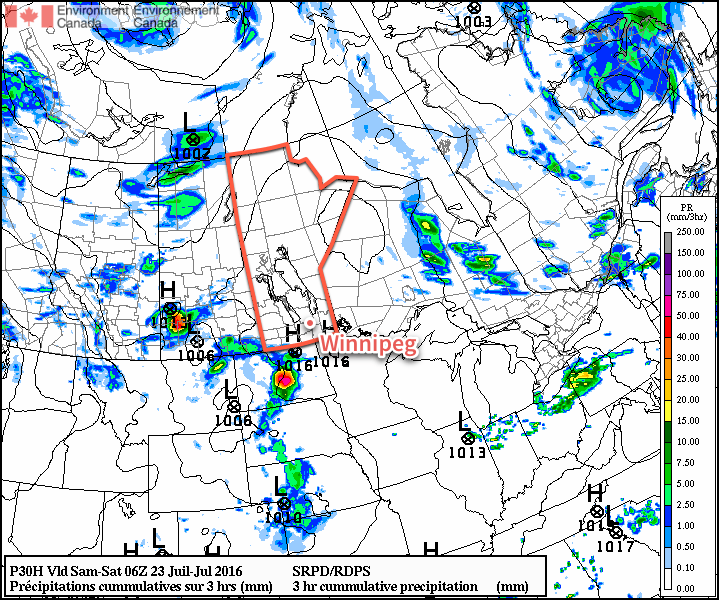
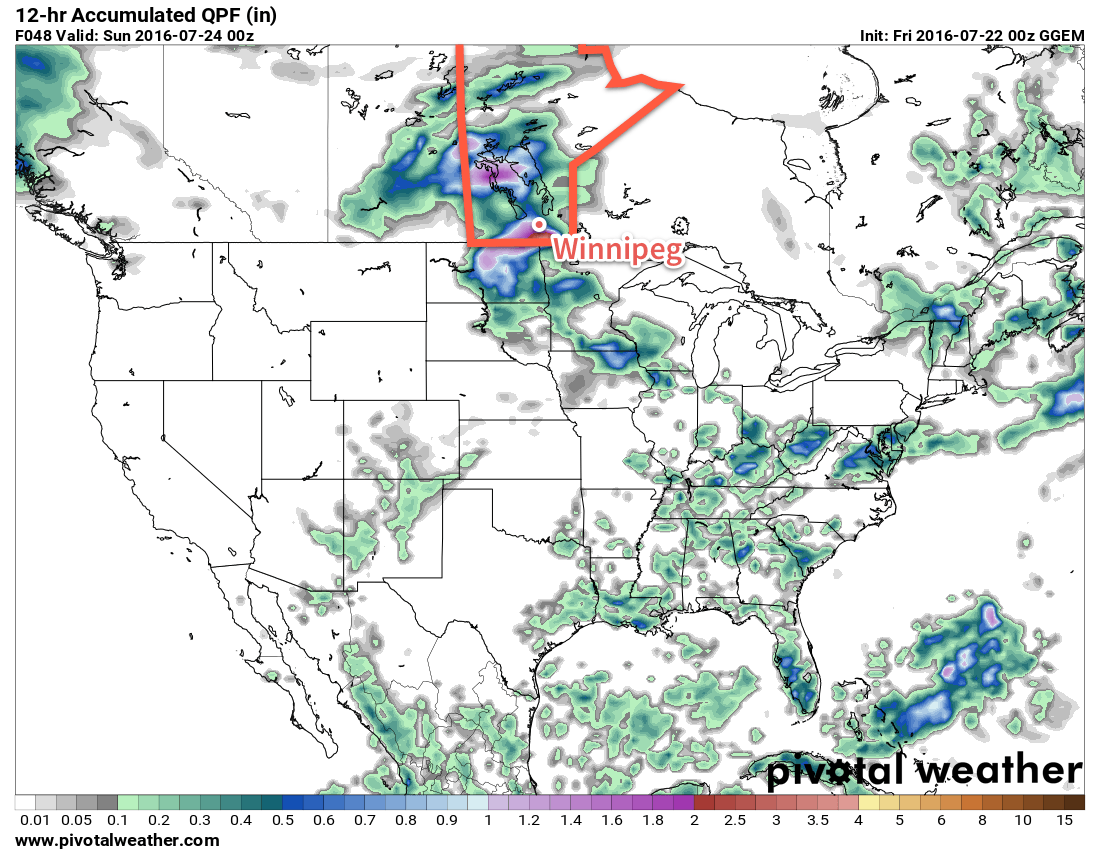
There will be rain on Saturday, however at this point, there’s still some uncertainty on exactly where precipitation will fall. Indications are that amounts will generally be 5-15 mm, however convective elements may produce rainfall amounts up to 30-50 mm in thunderstorm activity.

Ultimately we’ll simply have to wait and see how things shape up and what the nature is of the precipitation that develops through Montana and Saskatchewan tonight. We’ll provide updates in the comments below.
Much of the rain will taper off on Saturday evening, leaving us with fairly cloudy skies and a low that falls to around 16°C by Sunday morning.
Sunday will be a bit of a mixed bag. Expect mixed skies and a high near 26°C, however winds will be breezy, peaking out of the northwest at around 40 km/h and we’ll see just a slight chance of some scattered showers. Skies should clear for Sunday night as temperatures head to a low near 16°C.
Long Range
The start of next week looks fairly pleasant with sunny to mixed skies and daytime highs in the mid- to upper-20s. It looks like it will be fairly dry with a ridge of high pressure deflecting things south of the Red River Valley, but that will be sensitive to the exact location that this feature sets up.
Winnipeg’s seasonal daytime high is currently 26°C while the seasonal overnight low is 13°C.

Still
keeping a close eye on this one as models suggest two areas or rain,
one through the Interlake and one in North Dakota & near the
Canadian border, with varying placement and uncertain amounts of rain
connecting the two. Recent model runs are now hinting at a slightly
more progressive pattern which would possibly bring some sunshine for a
few hours, but potentially develop a line of strong-to-severe
thunderstorms rolling through the Red River Valley. We’ll be keeping a
close eye on how things develop and provide updates to our forecast as
needed.
As new model runs pour in, the picture for tomorrow appears to be changing dramatically. Essentially, it appears that there will be two waves of precipitation. First, an area of showers and/or thunderstorms will roll through in the morning, the continuation of nocturnal convection, with much of the precipitation tapering off through the Red River Valley by midday. We may see some sun, but I wouldn’t expect too much clearing. By mid-afternoon, best indications are a north-south line of thunderstorms will develop just west of the Red River Valley and then move across the Valley through the early evening hours. With some sunshine possible (vs. what was previously expected to be a totally cloudy day), the conditions for thunderstorms change significantly, with strong to severe thunderstorms possible.
Early indications are that all threats are possible, however the overall severity is expected to be much less than Wednesday. Later today or tonight we’ll do a more thorough look at the convective setup and update the post with a convective outlook for Saturday.