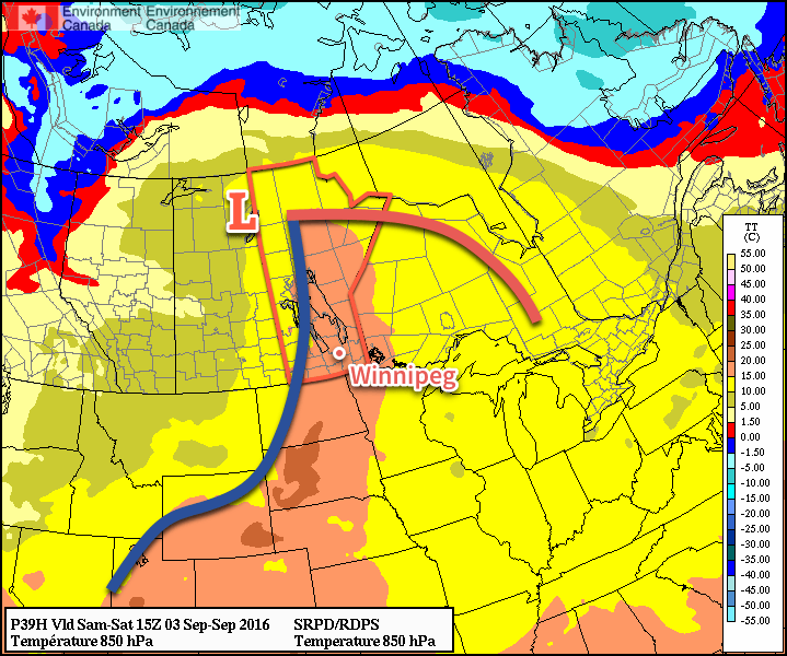
After a warm but windy day in Winnipeg & the Red River Valley today, the weather will turn unsettled for the weekend as multiple low pressure systems move through the province.
Today will be a warm and windy day over the Red River Valley. Temperatures will climb to a high near 27 or 28°C while strong southerly winds develop over the region ahead of a strengthening low pressure system in Saskatchewan. Winds near 30 km/h this morning will strengthen to 40 gusting 60 km/h by midday. That should be as strong as they get, however there is a slight chance that winds may reach as strong as 50 gusting 70 km/h.1 We should see plenty of sunshine, although by the second half of the afternoon some cloud cover will begin working into the region.
Tonight will be mild with plenty of cloud cover and windy conditions continuing. Winnipeg will see a chance of showers or thunderstorms overnight as the first weak impulse of many moves through. Expect a low near 18°C.

Saturday will bring fairly cloudy skies, albeit with a few sunny breaks likely in the morning, and a chance of showers or thunderstorms as a cold front pushes into the Red River Valley, slowing down and stalling out through the day. Winds will start out around 30 gusting 50 km/h and then taper off as the front moves into the valley. Temperatures will reach a high near 26 or 27°C.
Any shower or thunderstorm activity will slowly move towards the southeast through the evening, however may only barely make it east of the Red River Valley by morning.
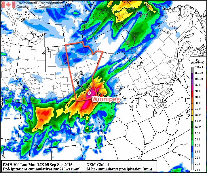
Sunday brings with it some uncertainty, but will likely be a wet day. For the first time in quite a while, we’ll be dealing with a Colorado Low moving through North Dakota and into northwestern Ontario. This system will push the front that passes through on Saturday back to the northwest, developing an area of rain that stretches from South Dakota all the way through Manitoba. How far west the rain will push remains an uncertainty; many models suggest the rain pushing northwest of Winnipeg with anywhere from 20-40 mm likely2 while others keep the entire area of rainfall just to the southeast of Winnipeg.

In either of those outcomes, it’s still quite likely that areas to the south of Winnipeg, particularly in the southern Red River Valley3 will see accumulating rain along with breezy winds out of the northeast.
Temperatures will be cooler on Sunday with a high near 22°C. The rain should taper off by Monday morning with temperatures dipping to a low near 12°C.
Extended Forecast: Labour Day Monday
Monday will be a fairly cloudy day with cool conditions left in the wake of the Colorado Low. Winds will be breezy out of the north as temperatures climb to a high near 19°C. There will likely be a continued chance of showers, but nothing to the extent of what will be seen in places on Sunday. Monday night looks to bring another chance for showers or thunderstorms ahead of yet another disturbance moving into the region.
Winnipeg’s seasonal daytime high is currently 21°C while the seasonal overnight low is 9°C.
