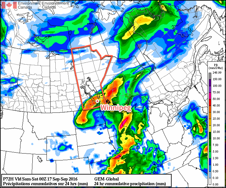
With the ridge of high pressure that brought the decidedly fall-like temperatures now moving off to the southeast, temperatures will begin to warm and head back towards seasonal. Although today will bring plenty of sun to the region, a low pressure system is heading our way from Idaho and will bring cloud and a renewed chance for rain for Thursday night and Friday.
A beautiful sunny day, hopefully unimpeded by a rogue cloud bank that should remain in North Dakota, will be in place through Winnipeg & the Red River Valley today. Our very cool start to the day will be quickly forgotten as temperatures climb to around the 20°C mark this afternoon with a southerly wind near 20 km/h. Tonight will be milder than last night with a low near 10°C.
Thursday will bring increasing cloudiness to the region ahead of an incoming low pressure system. A southerly wind once again near 20 km/h will continue to draw mild air northwards and help temperatures climb to a high near 22°C. By evening, an area of rain will likely push into the region from the southwest, with the wet weather continuing overnight as temperatures fall to a low near 14°C.

Friday will be mainly cloudy with a continued chance of rain through Winnipeg and the Red River Valley eastwards to the Ontario border. Winds will shift out of the north as the low pressure system moves into Ontario which will combine with the extensive cloud cover to keep our daytime high to just 16 or 17°C. As skies clear on Friday night, temperatures will dip to a cool low near 7°C.
Long Range
The weekend is looking quite pleasant with dry weather, plenty of sunshine and daytime highs returning to the low- to mid-20’s.
Winnipeg’s seasonal daytime high is currently 18°C while the seasonal overnight low is 6°C.
