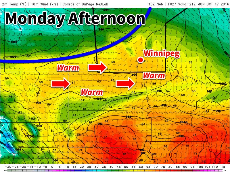
Today will be seasonably warm across southern Manitoba, but that is about to change. A looming cold front will bring cooler conditions by Tuesday.

This Week
Today will be the warmest day of the week in southern Manitoba. Mainly sunny skies and light westerly winds will allow temperatures to climb into the mid teens. Given that the normal high is only about 10C this time of year, today is well-above seasonal values. Unfortunately, that is about to change as a strong cold front pushes through southern Manitoba by Tuesday morning.
Tuesday will be significantly cooler than Monday as a rush of chilly arctic air descends from the north behind a cold front. High temperatures will only reach the mid to upper single digits. Skies will be a mixture of sun and cloud with breezy west winds of 20-30 km/h.
Wednesday will remain cool, as temperatures remain stuck in the mid single digits. Skies will be mainly cloudy with a slight chance of a shower or flurry. Winds will be breezy from the northwest at 20-30 km/h.
Long Range
The signal for the rest of the week’s weather is not particularly strong. Model guidance does hint at the potential for slight warm-up as we move into the weekend, but this is not completely certain. In general, high temperatures are expected to hover near the normal high for this time of year of 9-10°C. Longer range guidance shows higher probabilities of warmer than normal conditions are we move toward month’s end.
