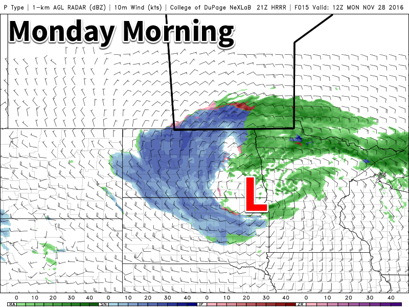
Our first significant Colorado Low in some time will bring a variety of precipitation types to southern Manitoba today. Rain, snow, freezing rain, and ice pellets will be possible.
Today
A powerful Colorado Low will bring a mixed-bag of precipitation to southern Manitoba today. Precipitation will likely start out as freezing rain or ice pellets in portions of the Red River Valley and south-eastern Manitoba this morning, before changing to rain later in the morning. Rainfall amounts of 5-10 mm are expected in most areas, with higher amounts possible near the International border. There may be a bit of snow at times, but little accumulation is expected – and any that were to accumulate will be melted by rain later in the day. However, the story will be different in western Manitoba, where snow will be the dominant precipitation mode for the day. Accumulations of 5-10 cm are likely in most areas by tonight. Winds will be gusty out of the north-east at 30 km/h gusting to 50 km/h, bringing some blowing and drifting to open parts of western Manitoba.
Tuesday
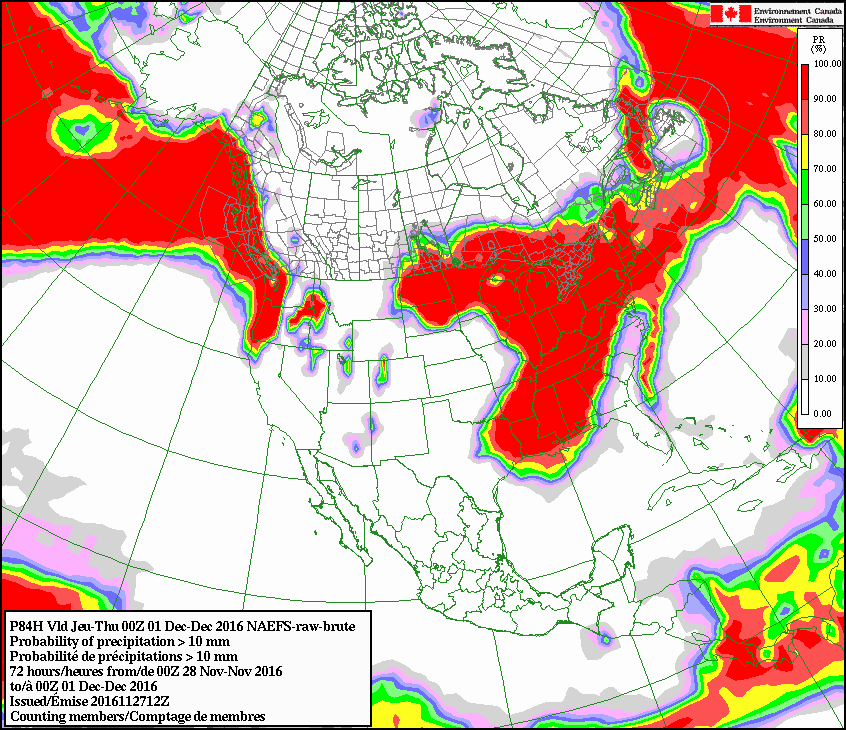
This Colorado Low will take its time exiting our region, affecting us once again on Tuesday. Unfortunately (for some), rain will change to snow on Tuesday in the Red River Valley and south-eastern Manitoba. Accumulations of 4-8 cm are likely in addition to possibly a couple millimetres of rain or mixed precipitation early in the day. Western Manitoba can expect another 5-10 cm on Tuesday, bringing totals up to 10-20 cm. The model graphic shown below, which considers a wide-range of possible solution, shows a very high probability (>80%) of over 10 mm of total precipitation in most of southern Manitoba. Winds will remain gusty out of the north on Tuesday at 30 km/h gusting to 50 km/h.
Wednesday
The Colorado Low will continue to linger on Wednesday, but snowfall rates will decrease. Flurries are expected throughout the day, but accumulations should be small. Winds will remain breezy from the north at 20-30 km/h.
Long Range
It appears that we’ll see generally seasonal to slightly-above seasonal temperatures as we move into early December. However, longer-range models do hint at a very cold arctic air mass being pulling down from the north about one week into the month. This will have to be monitored, as it would be our first significant bought of below-normal temperatures in quite awhile.