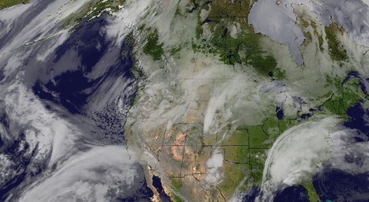
More snow is on the way for Southern Manitoba as a Colorado Low grazes the region as it moves through the Dakotas and Minnesota. After the passage of that system, the upper-level pattern will shift and bitterly cold Arctic air will spill southeastward across the Prairies.
Snow will build into Southern Manitoba through the day today from the southwest, with a few isolated flurries in the morning intensifying into more persistent snow through the afternoon. By 6PM, most areas along and south of the Trans-Canada Highway will be seeing snow. The snow will persist through much of the night before tapering off on Tuesday morning.

The NAM model pictured above has been consistently producing a total of between 6-8 cm at a 10:1 snowfall ratio (SLR), however it appears likely that the SLR will be higher at around 14:1, which would push storm-total snowfall ranges in the Red River Valley from around 8-12 cm in Winnipeg to 10-20 cm near the US border. Amounts States-side will be higher, with nearly 25cm of snow expected through east-central North Dakota into Minnesota.
Temperatures will be seasonal with highs in the -9 to -11°C range today and temperatures dropping to -18°C by Tuesday morning.
Winds will be breezy through the day today out of the northeast at around 20-30 km/h. As Winnipeg & the Red River Valley move onto the back-side of this system tonight, winds will strengthen out of the north to northwest to around 40 km/h. These gusty winds will combine with the fresh snowfall to produce blowing snow on area highways with locally poor visibilities. The winds will begin to ease through the early afternoon, bringing an end to the blowing snow.
Cooler Weather For The Remainder Of The Week
Temperatures will be much cooler on Tuesday with little movement from the overnight low near -18°C as colder air moves into the region from the northwest. Even colder conditions will move in on Tuesday night with overnight lows expected to drop to around the -27°C mark. Wednesday will see Winnipeg & the Red River Valley entrenched in the Arctic air with highs near the -22°C mark and an overnight low dipping back down to around the -27°C mark.

Skies on Tuesday will remain fairly cloudy until the late afternoon when things begin to break up. It doesn’t appear that this cold snap will be associated with particularly sunny skies, though. The main ridge axis will pass well to our west, making it more difficult for all of the cloud to clear from Southern Manitoba. The Red River Valley will mainly see mixed to cloudy skies through much of the week.
Long Range
Little pattern change is expected in the next 7-10 days.

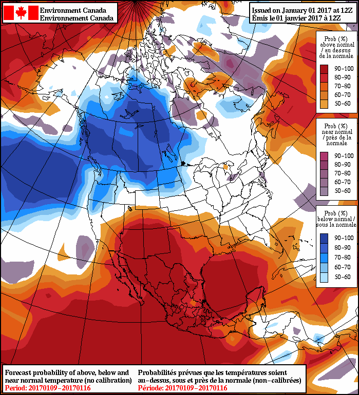
As this NAEFS outlook shows, below-normal temperatures will likely remain in place for the next 1-2 weeks. Temperatures may moderate next week to be closer, but still below, seasonal values. Conditions look fairly dry with little snow expected; the next potential for some snow may be with a clipper system early next week.
So after this snowfall, Winnipeg & region will be falling into a relatively quiet and cold pattern, holding strong for at least the next 7-10 days.
Winnipeg’s seasonal daytime high is currently -13°C while the seasonal overnight low is -23°C.

