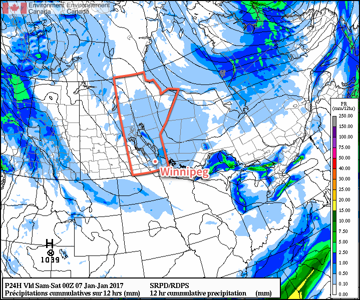
Below-normal temperatures will remain entrenched across Winnipeg & the Red River Valley as another weak disturbance brings some light snow and a reinforcing shot of Arctic air.
A weak disturbance moving across Southern Manitoba today will bring plenty of cloud and another batch of light snow to the region. While there will be a chance for some light snow throughout the day, it’s most likely to be seen through the afternoon and early evening. Fortunately it won’t amount to much with nothing more than a skiff expected. Temperatures will climb to a high near -19°C today, and then drop to a low near -27°C tonight as skies clear behind this system.

Saturday will bring fairly sunny skies and a high near -18°C. Winds will be relatively light, so it may actually be a nice day to be outside, despite the cool temperatures. Milder air will begin moving on on Saturday night ahead of a system that will impact the region on Sunday, so overnight lows won’t be quite as chilly as the past several. For Winnipeg, we’re expecting the temperature to drop to around -25°C.
Sunday brings more cloud and some light snow to the region once again as a weak disturbance rolls through. Temperatures will be milder with a high near -16°C and fairly light winds. Skies will clear on Sunday evening followed by plummeting temperatures with overnight lows likely falling into the -27 to -30°C range.
Long Range
Next week continues cold with temperatures mostly below the -20°C mark. Tuesday and Wednesday may be slightly warmer with highs in the mid-minus teens, but those warmer temperatures have the potential to bring some more now and the wind will be a bit more prominent, which may make it feel cooler than it does this weekend.
Winnipeg’s seasonal daytime high is currently -13°C while the seasonal overnight low is -24°C.
