Temperatures will moderate slightly for a near-seasonal weekend as a series of disturbances tracking along or just south of the U.S. border spread cloud and a chance of flurries across Southern Manitoba.
Today brings increasing cloudiness as a bit of morning cloud thickens up from the west through the afternoon ahead of the first of several systems. Temperatures will climb to a seasonal -11°C with fairly light winds. Cloudy skies tonight will keep temperatures from falling too far; the overnight low will be a reasonable (for early-February) -18°C.
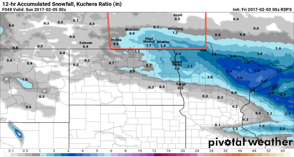
A low pressure system will track through North Dakota on Saturday with an inverted trough extending northwards from the low centre sweeping across Southern Manitoba. This will result in a fairly good chance of flurries or light snow with general amounts of 2-4 cm. Light winds will swing from south to northwest through the day.

Temperatures will reach a high near -9°C on Saturday with an overnight low near -19°C.
Sunday will be a bit of a mixed day as the main cloud shield from this system exits off to the east and the cloud shield from the next system begins moving in from the west. Thanks to cooler air pushing in behind Saturday’s system, daytime highs will be cooler at around -15°C, but the winds should be light. There will be just a slight chance of some flurries through the day. Expect a low near -20°C on Sunday night with winds beginning to shift out of the northeast by Monday morning.
Long Range
It appears that Monday and Tuesday will both bring chances for more organized snowfalls, with the second system showing some potential to be something that actually produces moderate widespread accumulations.1 After those two systems, a fairly potent ridge of high pressure moves in from the Arctic, sending temperatures well below normal for the middle of the week.

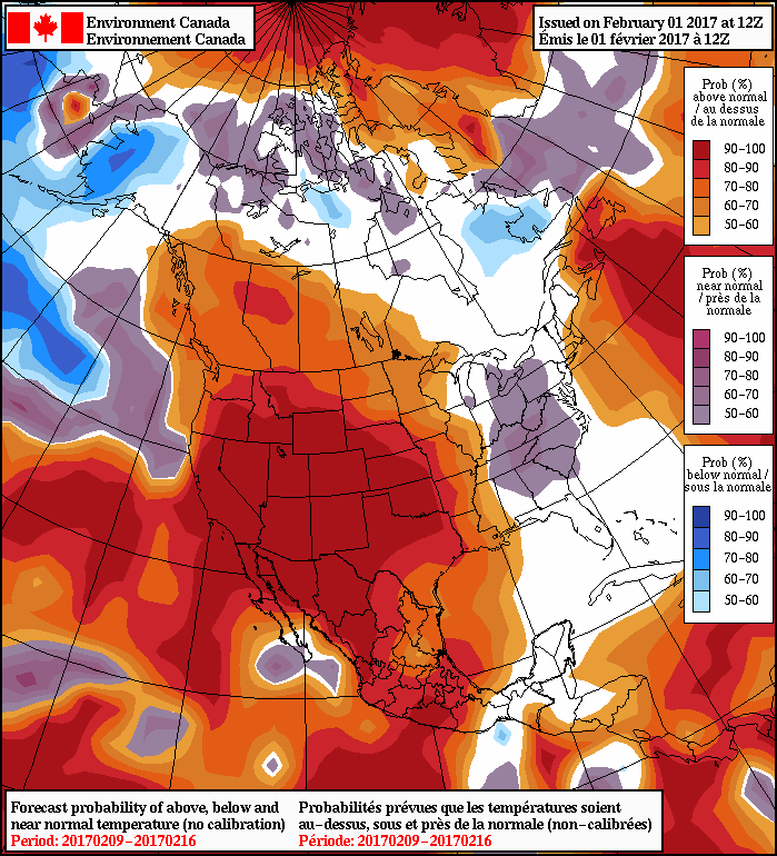
The cold snap looks to be short-lived, though. By the weekend, models suggest a significant pattern change with a more zonal flow becoming dominant and spreading milder Pacific air eastwards across the Prairies.
Winnipeg’s seasonal daytime high is currently -10°C while the seasonal overnight low is -21°C.
- At this point, models suggest that it could produce up to 10-15 cm of snow in portions of Southern Manitoba. ↩
