More cloud & light snow is on the way today before cooler temperatures and sunshine move into the region midweek.
More snow is on the way for Winnipeg as the final disturbance in a rather active storm track moves into the region. Before that, though, Winnipeg will see any remaining light snow taper off this morning as Sunday night’s low moves out of the region. The rest of the day will bring cloudy skies with a very slight chance of some scattered flurries and a high near -15°C.
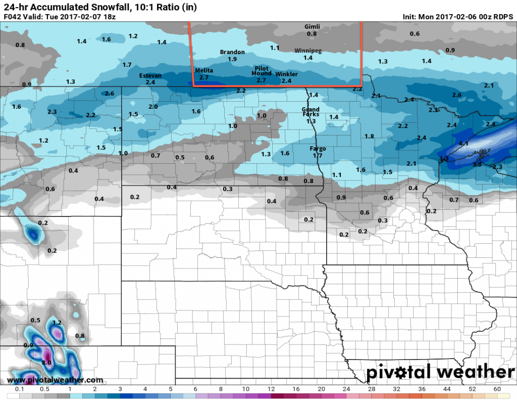
The last disturbance of the series will be moving through this evening, bringing another shot of snow to the Red River Valley. Amounts will be highest near the US border, with another dump of 5-10 cm expected. Amounts taper off heading northwards, with around 2-4 cm expected along the Trans-Canada Highway corridor, including Winnipeg.
Temperatures will drop to a low near -19°C tonight.

Wednesday will see things finally settle down, with partly cloudy skies and a below-normal high near -17°C, all courtesy a ridge of high pressure swinging through. Skies will remain clear on Wednesday night as temperatures dip to a low near -23°C.
Long Range
The colder weather will be short-lived, fortunately, as warmer weather returns for the weekend. Alongside a couple chances fro some light snow, it appears that Winnipeg & the Red River Valley will be heading into a prolonged period of above-normal temperatures, with daytime highs in the generally between -10 and -5°C by the weekend and persisting through next week!
Winnipeg’s seasonal daytime high is currently -10°C while the seasonal overnight low is -20°C.
