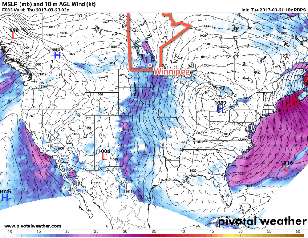
The wind will be back today, but this time rather than slamming colder temperatures southwards through the Red River Valley, it will be gradually bringing warmer weather back to the region. A generally warm and dry pattern will establish itself for the coming week or so, likely bringing a gradual spring melt to the Red River Valley.
As warmer weather once again moves into the Red River Valley today, like clockwork those southerly winds will ramp up and become the main weather feature of the day. The winds will increase through the morning to 30-40 km/h by midday, and then further strengthen in the afternoon to 40 gusting 60 km/h.1 These strong winds will likely persist much of the night before dropping off on Thursday morning. While all this happens, Winnipeg & the Red River Valley will see a sunny morning give way to cloudy skies midday into the early afternoon as temperatures climb to a high near -1°C late in the day.

The cloudy skies will continue overnight with a slight chance of some light snow2 as a warm front associated with a low pressure system passing across the central Prairies moves through. Temperatures will remain steady near -2°C.
Thursday will bring the spring warmth as we enter the warm sector of the system passing by to the north. Temperatures will climb above normal for much of the Red River Valley with high temperatures the +5 to +7°C range. The winds will ease off in the morning and we’ll be left with mixed to cloudy skies. A weak cold front will slump through late in the day, but have little effect on temperatures overall; Thursday night will see a low of just -3°C or so under fairly cloudy skies.
Friday will see temperatures return to near-seasonal values with a high near +2°C under partly cloudy to mixed skies. The lack of any notable winds will make it a pleasant day. Lows will drop to around -3°C on Friday night.
Long Range
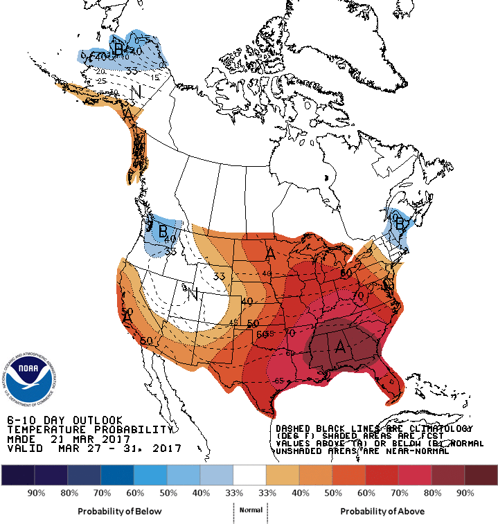
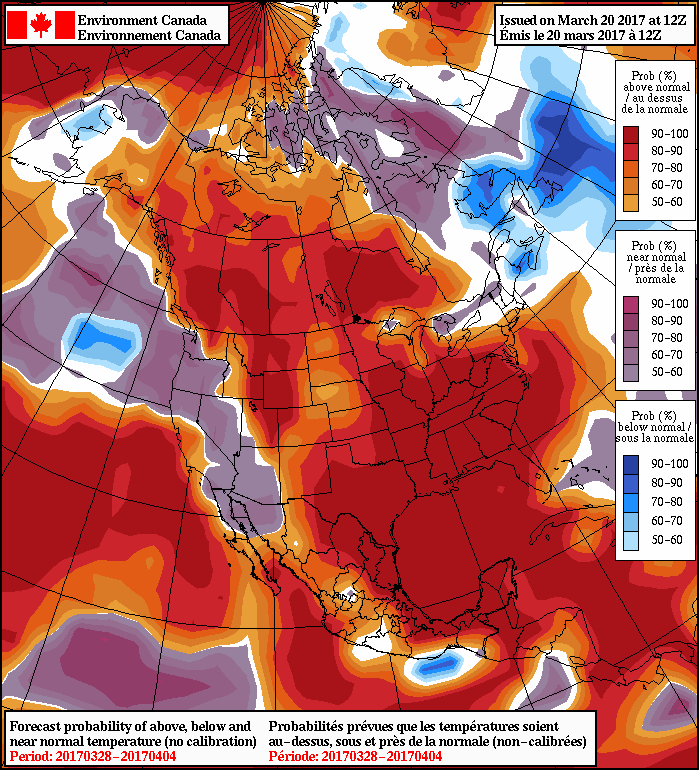
The long range forecast is definitely pointing towards the arrival of spring not just for southern Manitoba, but a vast amount of North America. A stable long-wave pattern will be developing over the southern Prairies for the coming 1-2 weeks, bringing relatively dry conditions and ample warm air.

Daytime highs will climb into the mid- to upper-single digits this weekend and remain there for much, if not all, of the coming week. Throughout this period, it looks like the potential for rain across the Red River Valley is fairly low. Some models hint at a chance for some light rain or snow on Sunday night, but otherwise keep things fairly dry.

Overall, even into the Week 2 timeframe, temperatures look to remain above normal…nearly everywhere. It’s practically a certainty that we’ll be seeing the elimination of the snowpack across the Red River Valley in the coming days, and a substantial melting, if not elimination, of the substantial snowpack over southwestern Manitoba and southeastern Saskatchewan that was produced by the major blizzard last week.
All is not fun and games, though, as the melt, particularly in drainage channels to the Assiniboine river, will transition the region towards dealing with flooding concerns. Fortunately, much of the snowpack has already been eliminated in the North Dakota Red River Valley, which will help ease things slightly. Spring flood forecasts are the responsibility of the Manitoba Government. News and updates can be found here.
Winnipeg’s seasonal daytime high is currently 1°C while the seasonal overnight low is -9°C.
