We got a short forecast for you today: beautiful! Nothing but sunshine and warmth on the way for Winnipeg this weekend.
The weather over the coming days will be a result of the upper-level ridge we talked about on Wednesday, which is bringing sunny and warm weather to the region.

Winnipeg and the Red River Valley will see plenty of sunshine over the coming days with daytime highs in the 19-22°C range and overnight lows gradually warming from around 6°C up to 10 or 11°C by Friday night. Winds pick up out of the northeast today to 20-30 km/h, but then diminish for Saturday. Sunday will see a winds pick up out of the southeast once again to 20-30 km/h.
Long Range
The upper-level ridge will collapse on Monday as a shortwave digs into the Prairies, bringing with it a chance for some rain. Temperatures will remain mild with highs near 20°C though.

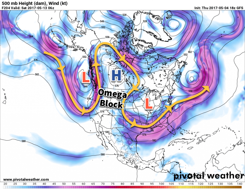
Rapidly after Monday’s disturbance, an omega block — named such as the shape of the jet stream inside one resembles the greek letter Ω — will develop, rooted over the Canadian Prairies. While this will bring cooler, wet weather to both the west coast and eastern Canada, it will bring a prolonged stretch of warm and dry weather to southern Manitoba.
Enjoy getting outside in this fantastic spring weather!
Winnipeg’s seasonal daytime high is currently 17°C while the seasonal overnight low is 3°C.
