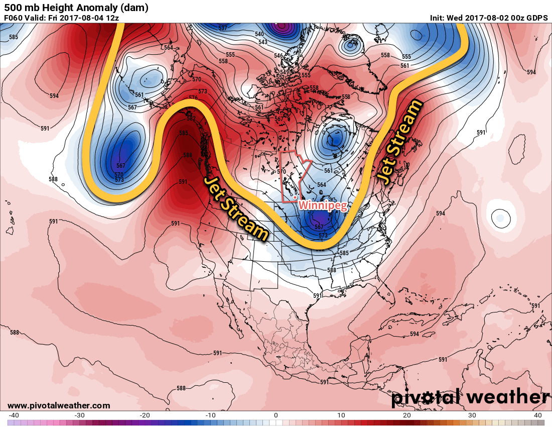
A big change is on the way for Winnipeg and the Red River Valley; after a stretch of hot and humid weather, the jet stream is plunging southwards and will spread significantly cooler conditions across the southern Prairies.
Today’s weather will be dominated by an upper-level low tracking into North Dakota, shunting the jet stream further south and bringing cooler air into the region. Here in Winnipeg, temperatures will climb to around 21°C this afternoon — some 5°C below normal — with northerly winds at around 15-20 km/h. We may see a few showers in the morning, but most of the day should be cloudy with no rain. Skies will clear out late tonight into the early morning hours of Thursday as temperatures dip to a low near 11°C.

Thursday will bring clearing skies as a broad ridge of high pressure builds into the region. Winds will remain light, and with a bit of sunshine highs should be a little higher than Wednesday at around 24°C. There will be a very slight chance of an isolated shower developing along lake-breeze boundaries in the Interlake and drifting south towards Winnipeg in the late-afternoon, but that the chance is low. Skies will be clear Thursday night with a low near 11 or 12°C once again.
Friday will be more of the same; light northwesterly winds under partly cloudy skies with a high near 24°C. Temperatures will dip down to a low near 13°C on Friday night.
Long Range
Saturday will continue the cooler conditions with a high in the low 20’s, but a passing disturbance will bring a slight chance of some scattered showers or thunderstorms. The remainder of the weekend into next week will bring seasonal to slightly below-seasonal temperatures with mixed skies and occasional chances for showers.
Winnipeg’s seasonal daytime high is currently 26°C while the seasonal overnight low is 13°C.
