Temperatures will hover at seasonal to slightly above-seasonal values until a low pressure system moves through on Friday and kicks off a major pattern change that will bring significantly cooler weather to the region.
Winnipeg has a couple nice days ahead as a ridge of high pressure keeps skies fairly clear and temperatures continue slightly above normal with highs in the mid-to-upper 20’s. Winds will be light today, but pick up out of the south on Thursday to around 30-40 km/h as a trough of low pressure moves into Saskatchewan. Tonight will see a low near 12°C, but on Thursday night a combination of cloud cover moving in, continuing windy conditions, and increasing dew points will keep lows much higher at around 17°C.

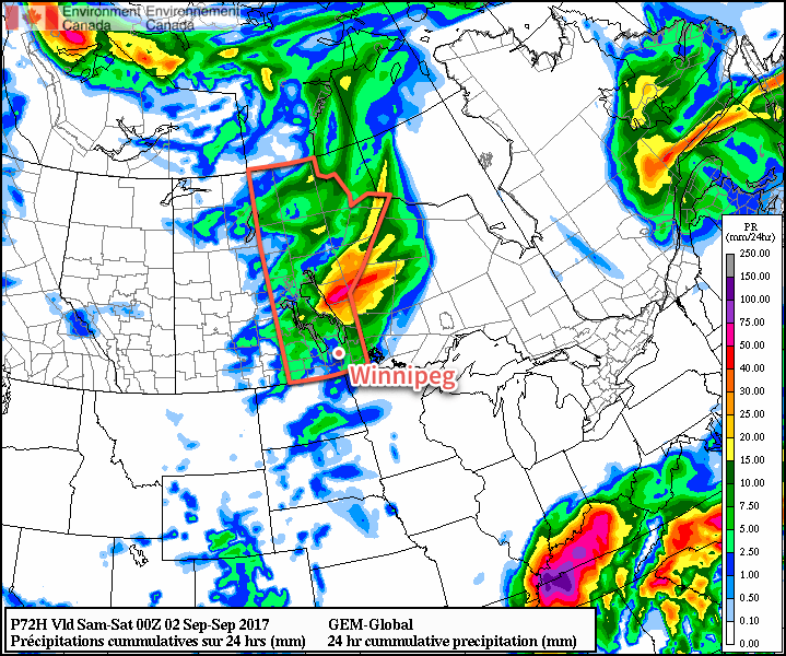
Friday’s main focus will be a low pressure system tracking eastwards through the province. At this point, it appears that it will likely develop an area of thunderstorms over Saskatchewan on Thursday afternoon, then track into Manitoba overnight. The exact placement and timing of the system has a lot of uncertainty at the moment simply due to the unpredictable nature of convection in the long-range, but in general it appears that Winnipeg will see a chance of showers or thunderstorms from fairly early in the morning until mid-afternoon or so, followed by winds shifting out of the northwest and clearing skies. It will also be a bit of a muggy day with dew points climbing into the upper teens. We’ll be able to paint a much clearer picture of this system in our next forecast post.
Long Range
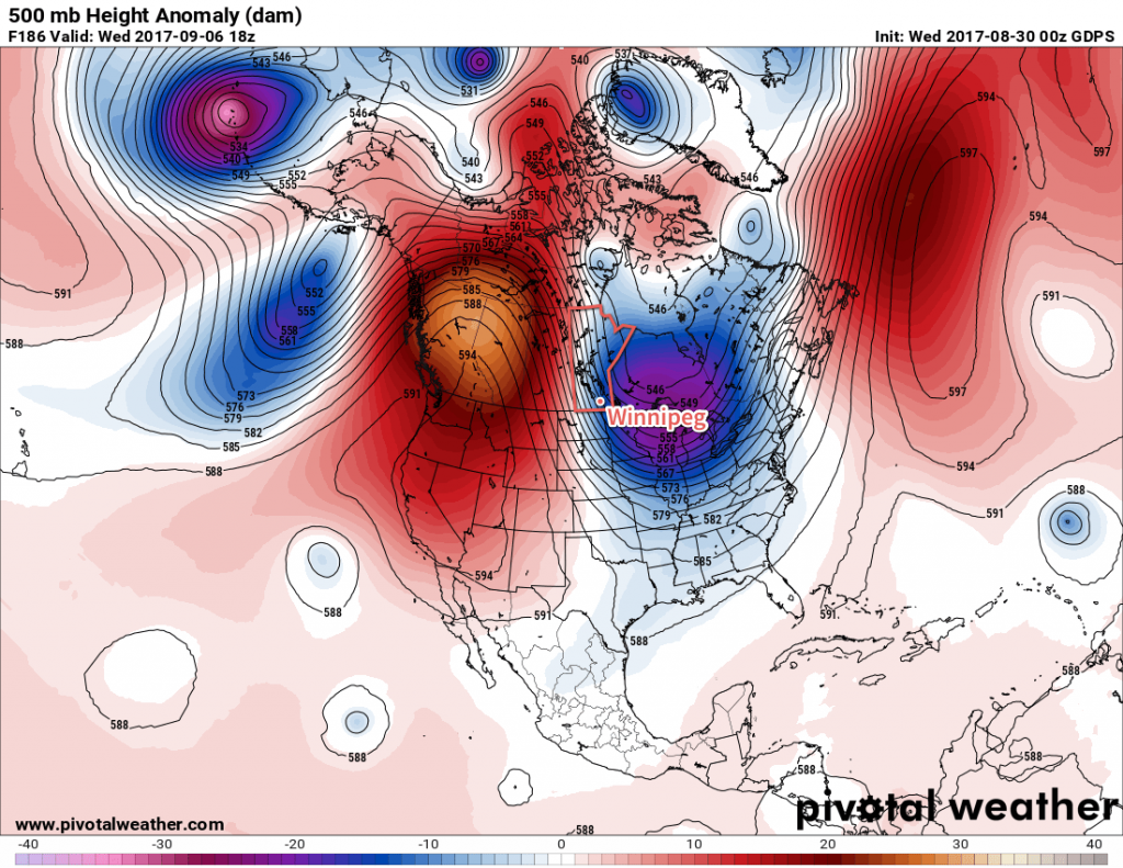
The biggest weather story for the region will be the transition that takes place behind Friday’s system. Once it moves through, the upper-level ridge over western Canada is expected to amplify quite significantly, bringing another heat wave to B.C. and portions of Alberta. The flip-side to that will be the digging of a long-wave trough over central Canada, which will bring a northwesterly flow to our region and allow much cooler air to spill southwards out of the Arctic.

This could bring daytime highs as cool as 15-16°C by early next week, around 5°C below normal. This pattern would also likely bring partly cloudy to mixed skies and occasional chances for showers. It appears conditions will begin returning towards normal late next week and through the weekend.
Winnipeg’s seasonal daytime high is currently 22°C while the seasonal overnight low is 9C.
