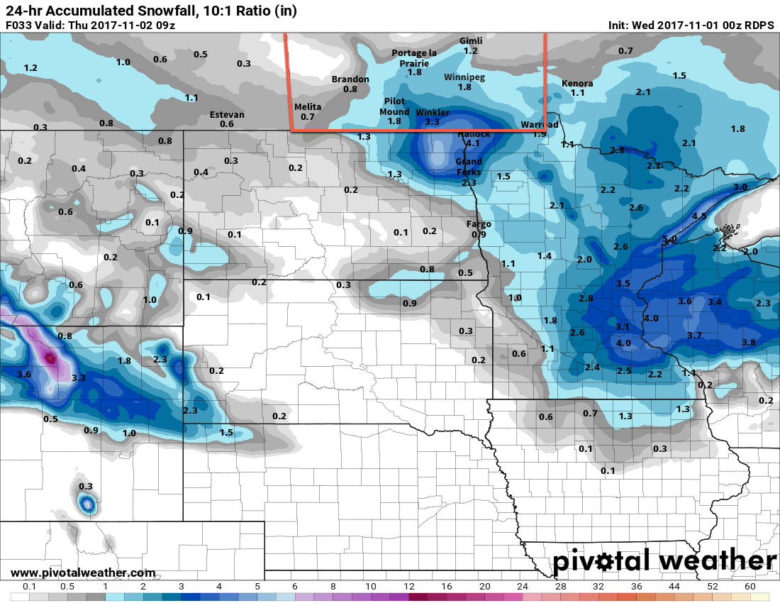
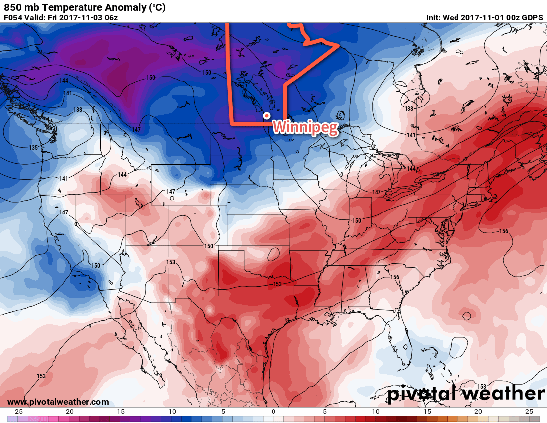
November will be off to a snowy start as a clipper system tracking across North Dakota spreads snow across southern Manitoba today. In the wake of this low, an Arctic ridge will build into the Prairies and bring unseasonably cool temperatures to the region.
Light snow is on the way for Winnipeg today as snow spreads through the Red River Valley, supported by a low pressure system tracking across North Dakota. The snow will begin early this morning and persist throughout the day before tapering off later this evening. By the time snow tapers off, this system will produce generally 5-10 cm of snow along and south of the Trans-Canada Highway corridor with highest amounts near the US border decreasing northwards. The fly in the ointment, as it were, will once again be temperatures that climb up to or just above the freezing mark. The mild conditions will result in quite a bit of snow melt, however it’s likely that a few centimetres accumulate by the end of the day. That said, it won’t quite be the widespread blanketing that it would be if things were even a couple degrees cooler.

Aside from the snowfall, it will be a relatively pleasant day. Temperatures will climb to a high near +1°C with winds out of the east-northeast at 20 to 30 km/h. Heading into the evening, the winds will shift to the north at around 30 km/h with snow tapering off as temperatures dip to a low near -2°C under mostly cloudy skies.
Thursday will bring mostly cloudy skies to Winnipeg and area, although a few sunny breaks are possible. Temperatures will recover just barely to -1°C as a breezy northerly wind continues, marking the gradual approach of a large Arctic-sourced high pressure system. The cloud cover will break up in the evening as winds drop off, which will send temperatures plummeting to a low near -10°C as colder Arctic-sourced air arrives.

Winnipeg will see mixed skies on Friday with temperatures climbing back to around -3°C with light winds. Expect the cloud cover to thicken back up on Friday night in advance of the next system that will move through this weekend as lows dip down to into the -7 to -10°C before beginning to moderate towards Saturday morning.
Long Range Outlook
Saturday and Sunday will both be largely influenced by a major low pressure system tracking across the Prairies. A warm front will push through on Saturday, bringing rain and snow to the region as temperatures climb just above freezing again. There will likely be a break in the precipitation, but then a cold front will sweep through Saturday night into Sunday, bringing more snow and breezy northwesterlies as temperatures plunge well below seasonal.

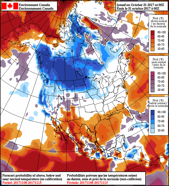
Next week looks very cold as the jet stream plunges south, allowing Arctic air to spill southwards across the Prairies. If you haven’t already, it’s probably time to get the winter jacket and gloves out!
Winnipeg’s seasonal daytime high is currently 4°C while the seasonal overnight low is -5°C.
