And it’s not changing any time soon.
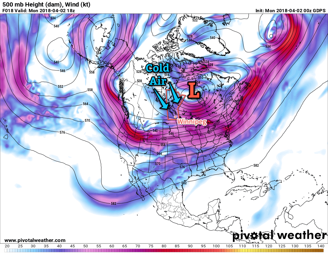
Spring will be decidedly absent in Winnipeg this week as a persistent northwesterly flow aloft over the eastern Prairies continues to usher cold Arctic air southwards. This is all due to a persistent vortex over Hudson Bay that refuses to budge and will remain in the area for the coming 7 days.

Winnipeg will see daytime highs ranging from -10 to -4°C over the next several days, over 10°C below seasonal for this time of year. Overnight lows will be very cold tonight, dipping all the way down to -22°C thanks to the Arctic front which dropped southwards overnight. A weak warm front moving through on Tuesday1 will bring milder, but still well below-seasonal, overnight lows near -15°C for Tuesday and Wednesday night.
Skies will start out mainly sunny today, with a few more clouds moving in on Tuesday and skies becoming mixed on Wednesday.
Winds will be breezy out of the north today at 20 to 30 km/h, then taper off for the night. Winds will be a bit lighter on Tuesday out of the northwest at around 20 km/h, but then strengthen to westerly 30 gusting 50 km/h on Wednesday.
Long Range Outlook
A very gradual warming trend will continue through the remainder of the week, but temperatures are still expected to remain below-normal into next week. Daytime highs should climb back above 0°C this weekend, but will come at the cost of increasing cloud cover and a chance for rain or snow as a low pressure system moves through in the latter half of the weekend into the start of next week.
Booooo!
Winnipeg’s seasonal daytime high is currently 6°C while the seasonal overnight low is -5°C.
- Or rather, more like the Arctic air leaving the region. ↩
