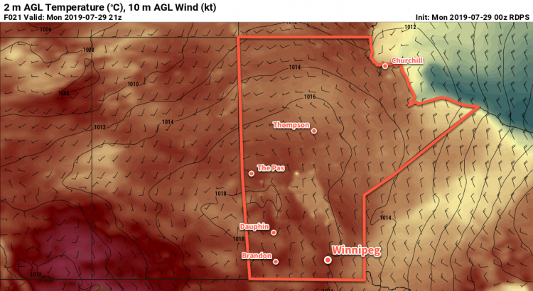
Winnipeg will see seasonably cool temperatures to start the new work week, but warmer weather will quickly return.
Breezy northwesterly winds on the backside of a low pressure system that crossed the province yesterday will bring cooler conditions to Winnipeg today. The city will see a cloudier start to the day with a chance of a few showers. Skies will gradually clear through the morning with northwest winds increasing to 30 gusting 50 km/h. Once the sun is out this afternoon, temperatures will climb to a seasonably cool high of 21°C.
A ridge of high pressure will move into the province tonight, bringing light winds and a low near 7°C.
The same ridge of high pressure will bring beautiful weather to the city for Tuesday: plenty of sunshine, light winds, and a seasonal high near 25°C!
A few clouds will likely push into the region on Tuesday night as temperatures head to a low near 12°C.
Hotter conditions will redevelop over southern Manitoba on Wednesday ahead of a low pressure system moving through Saskatchewan. The city will see increasing southerly winds with temperatures climbing to a high near 28°C. Skies should stay partly cloudy through the day with most of this system’s cloud moving across northern Manitoba.
Heading into Wednesday night, the chance for thunderstorms will develop as the region shifts into a more unsettled pattern. Temperatures will stay warm with a low near 18°C. We’ll be able to give a better idea of the chances for thunderstorms in our mid-week forecast.
Long Range Outlook
The rest of the week should see warm weather with increasing humidity. The general pattern will become more unsettled, but it’s far too early to be able to nail down any specific timing for any showers or thunderstorms. In general, though, it appears that the region will head into a warmer stretch with variable cloudiness and the potential for unsettled conditions.
Today’s seasonal daytime high in Winnipeg is 26°C while the seasonal overnight low is 13°C.

